Welcome, Kapamilya! We use cookies to improve your browsing experience. Continuing to use this site means you agree to our use of cookies. Tell me more!
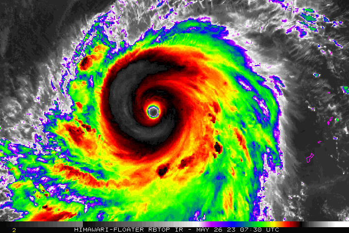
But compared to super typhoon Yolanda, which barreled through the central part of the country in 2013, Mawar relatively weaker, according to weather scientists.
Yolanda swept through the country with maximum sustained winds of 235 kilometers per hour at a moving speed of 35 kilometers per hour.
State weather bureau Pagasa's weather division chief Jun Galang said Mawar is moving at a slower pace.
“Yung kagandahan ngayon nasa dagat at yung forecast natin, hihina siya bago lumapit dito sa may Batanes island. I think magiging typhoon intensity 175 km pero malakas pa rin yun,” Cayanan added.
Cayanan said this should not make the public complacent as Mawar can still be dangerous.
“Pag mas mabilis ang speed niya, yung impact niya sa land mas malakas. Kung mabagal man ang speed niya, yung ibubuhos niya na ulan, mas marami. So wala naman tayong mapagpipilian, mabagal o mabilis, mapaminsala sila pareho,” he said.
ABS-CBN is the leading media and entertainment company in the Philippines, offering quality content across TV, radio, digital, and film. Committed to public service and promoting Filipino values, ABS-CBN continues to inspire and connect audiences worldwide.
Our website is made possible by displaying online
advertisements to our visitors. Please consider supporting
us by disabling your ad blocker on our website.
Our website is made possible by displaying online
advertisements to our visitors. Please consider supporting
us by disabling your ad blocker on our website.