3 areas still under Signal No. 1 as Obet nears Luzon | ABS-CBN

Welcome, Kapamilya! We use cookies to improve your browsing experience. Continuing to use this site means you agree to our use of cookies. Tell me more!
3 areas still under Signal No. 1 as Obet nears Luzon
3 areas still under Signal No. 1 as Obet nears Luzon
ABS-CBN News
Published Oct 20, 2022 12:50 PM PHT
|
Updated Oct 20, 2022 07:22 PM PHT
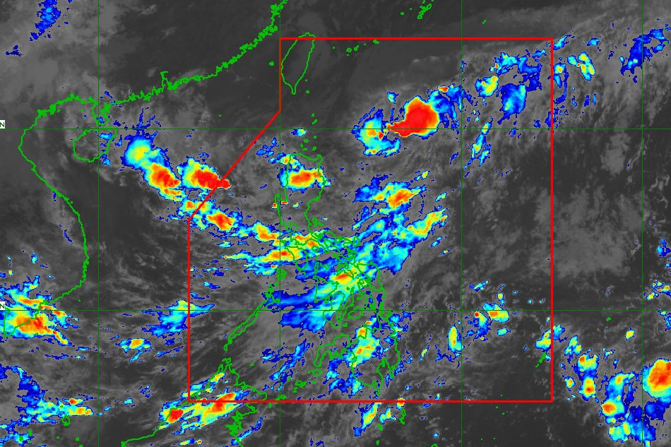
MANILA (UPDATE) — Three areas in northern Luzon remain under Signal No. 1 on Thursday afternoon due to the threat of tropical depression Obet, PAGASA said.
MANILA (UPDATE) — Three areas in northern Luzon remain under Signal No. 1 on Thursday afternoon due to the threat of tropical depression Obet, PAGASA said.
In its 5 p.m. bulletin, the state weather bureau placed Batanes, Babuyan Islands, and northeastern portion of mainland Cagayan (covering the towns of Santa Ana and Gonzaga) under the said tropical cyclone wind signal.
In its 5 p.m. bulletin, the state weather bureau placed Batanes, Babuyan Islands, and northeastern portion of mainland Cagayan (covering the towns of Santa Ana and Gonzaga) under the said tropical cyclone wind signal.
Areas under Signal No. 1 are advised to prepare for strong winds between 39 to 61 kph within the next 36 hours.
Areas under Signal No. 1 are advised to prepare for strong winds between 39 to 61 kph within the next 36 hours.
Batanes and Babuyan Islands are among the areas in Luzon that are still reeling from the effects of typhoon Neneng earlier this month.
Batanes and Babuyan Islands are among the areas in Luzon that are still reeling from the effects of typhoon Neneng earlier this month.
ADVERTISEMENT
PAGASA said Obet maintained its strength as it continued to move westward.
PAGASA said Obet maintained its strength as it continued to move westward.
It may cross the Babuyan Islands-Batanes area and reach tropical storm category between Friday evening and Saturday morning, the weather agency said.
It may cross the Babuyan Islands-Batanes area and reach tropical storm category between Friday evening and Saturday morning, the weather agency said.
From early Friday, moderate to heavy with at times intense rains are possible over Batanes, Babuyan Islands, Apayao, and the northern portions of Ilocos Norte and mainland Cagayan, said PAGASA.
From early Friday, moderate to heavy with at times intense rains are possible over Batanes, Babuyan Islands, Apayao, and the northern portions of Ilocos Norte and mainland Cagayan, said PAGASA.
Meanwhile, light to moderate with at times heavy rains are expected over the northern portion of Ilocos Sur, Abra, Kalinga, and the rest of Ilocos Norte and mainland Cagayan.
Meanwhile, light to moderate with at times heavy rains are expected over the northern portion of Ilocos Sur, Abra, Kalinga, and the rest of Ilocos Norte and mainland Cagayan.
"Under these conditions, flooding and rain-induced landslides are possible," PAGASA warned.
"Under these conditions, flooding and rain-induced landslides are possible," PAGASA warned.
It said Obet was 650 kilometers east of Basco, Batanes at 4 p.m., packing maximum winds of 45 kilometers and up to 55 kph gusts.
It said Obet was 650 kilometers east of Basco, Batanes at 4 p.m., packing maximum winds of 45 kilometers and up to 55 kph gusts.
"Sa ngayon wala pa naman yung direktang epekto nitong bagyo sa ano mang bahagi ng bansa, ngunit meron na nga tayong mga bagong weather systems na nakakaapekto," PAGASA weather specialist Raymond Ordinario said in a 5 p.m. Facebook livestream.
"Sa ngayon wala pa naman yung direktang epekto nitong bagyo sa ano mang bahagi ng bansa, ngunit meron na nga tayong mga bagong weather systems na nakakaapekto," PAGASA weather specialist Raymond Ordinario said in a 5 p.m. Facebook livestream.
(The cyclone has no direct effect yet on any part of our country, but we have new systems affecting the weather.)
Cloudy skies with scattered rains will prevail in the Visayas and southern Luzon due to an inter-tropical convergence zone (ITCZ) or band of clouds, he said.
(The cyclone has no direct effect yet on any part of our country, but we have new systems affecting the weather.)
Cloudy skies with scattered rains will prevail in the Visayas and southern Luzon due to an inter-tropical convergence zone (ITCZ) or band of clouds, he said.
Meanwhile, the amihan is affecting northern Luzon, Ordinario said.
Meanwhile, the amihan is affecting northern Luzon, Ordinario said.
For more updates, visit the ABS-CBN weather center.
— With a report from Ariel Rojas, ABS-CBN News
RELATED VIDEO
ADVERTISEMENT
ADVERTISEMENT


