Welcome, Kapamilya! We use cookies to improve your browsing experience. Continuing to use this site means you agree to our use of cookies. Tell me more!
Raising wind signal possible in Batanes, Babuyan islands amid Inday, says PAGASA
Raising wind signal possible in Batanes, Babuyan islands amid Inday, says PAGASA
ABS-CBN News
Published Sep 10, 2022 08:04 AM PHT
|
Updated Sep 10, 2022 12:11 PM PHT
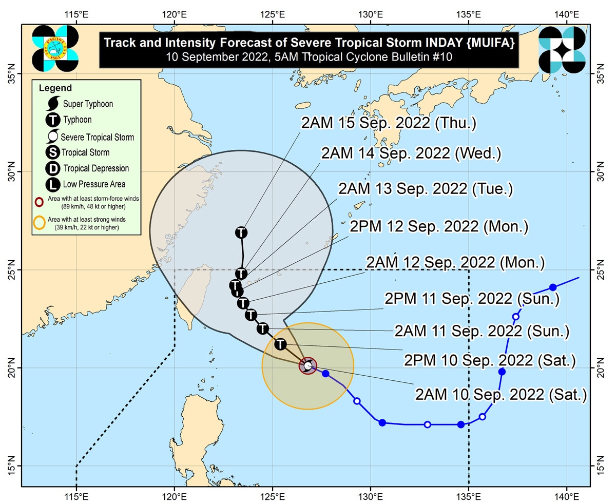
This PAGASA photo shows the location of storm Inday at 5 a.m. Saturday.
MANILA — State weather bureau PAGASA said Saturday it could raise tropical cyclone wind signal over extreme northern Luzon, as severe tropical storm Inday is set to become a typhoon and expand its size.
"Possible na mahagip itong Batanes and even Babuyan group of islands, possible tayong magtaas ng tropical cyclone wind signal worst-case scenario po natin 'yan," PAGASA weather forecaster Benison Estareja said.
Inday (international name: Muifa) has maintained its strength while it "slightly" accelerates over the Philippine Sea, PAGASA also said.
Sighted 495 kilometers east of Basco, Batanes at 4 a.m., Inday is packing maximum sustained winds of 110 kph near the center and gusts of up to 135 kph.
ADVERTISEMENT
It is moving west-northwestward at 20 kph and may leave the Philippine area of responsibility by late Tuesday or early Wednesday next week.
Meanwhile, cloudy skies with scattered rain showers and thunderstorms may be experienced over Calabarzon, Mimaropa, Bicol Region, Western Visayas, Bataan, and Zambales in the next 24 hours due to the trough or extension of storm Inday, PAGASA said in its 4 a.m. advisory.
Metro Manila and the rest of the country can expect isolated rain showers due to localized thunderstorms.
ABS-CBN is the leading media and entertainment company in the Philippines, offering quality content across TV, radio, digital, and film. Committed to public service and promoting Filipino values, ABS-CBN continues to inspire and connect audiences worldwide.
Our website is made possible by displaying online
advertisements to our visitors. Please consider supporting
us by disabling your ad blocker on our website.
Our website is made possible by displaying online
advertisements to our visitors. Please consider supporting
us by disabling your ad blocker on our website.