Welcome, Kapamilya! We use cookies to improve your browsing experience. Continuing to use this site means you agree to our use of cookies. Tell me more!
Inday intensifies into a typhoon, monsoon rains possible — PAGASA
Inday intensifies into a typhoon, monsoon rains possible — PAGASA
ABS-CBN News
Published Sep 10, 2022 12:05 PM PHT
|
Updated Sep 10, 2022 06:22 PM PHT
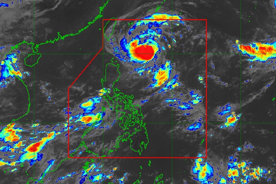
This PAGASA photo shows the location of typhoon Inday at 10:40 am Saturday.
MANILA — Inday (international name: Muifa) has intensified into a typhoon, state weather bureau PAGASA said Saturday.
Although Inday remains unlikely to directly bring rains over the country, its trough or extension may bring heavy rain showers during thunderstorms over the eastern section of southern Luzon and the western portion of Central Luzon, according to PAGASA.
PAGASA added that Inday could enhance the southwest monsoon or habagat, which may bring rains over the western sections of southern Luzon and Visayas.
Inday was last spotted 430 kilometers east of Basco, Batanes at 11 a.m., packing maximum sustained winds of 120 kph near the center and gusts of up to 150 kph. It is moving northwestward at 15 kph.
ADVERTISEMENT
"Further intensification will continue until Sunday or Monday as Inday tracks northwestward over the Philippine Sea," it added.
Despite its strength, raising of wind signals in any part of the archipelago is less likely "at this time," PAGASA said.
But "further westward shift in the track forecast and/or expansion in the extent of tropical cyclone winds may result in the hoisting of wind signals over portions of Extreme Northern Luzon."
Meanwhile, cloudy skies with scattered rain showers and thunderstorms may be experienced over Calabarzon, Mimaropa, Bicol Region, Western Visayas, Bataan, and Zambales in the next 24 hours due to the trough or extension of storm Inday, PAGASA said in its 4 a.m. advisory.
Metro Manila and the rest of the country can expect isolated rain showers due to localized thunderstorms.
Inday could leave the Philippine area of responsibility by late Tuesday or early Wednesday next week.
ABS-CBN is the leading media and entertainment company in the Philippines, offering quality content across TV, radio, digital, and film. Committed to public service and promoting Filipino values, ABS-CBN continues to inspire and connect audiences worldwide.
Our website is made possible by displaying online
advertisements to our visitors. Please consider supporting
us by disabling your ad blocker on our website.
Our website is made possible by displaying online
advertisements to our visitors. Please consider supporting
us by disabling your ad blocker on our website.