Welcome, Kapamilya! We use cookies to improve your browsing experience. Continuing to use this site means you agree to our use of cookies. Tell me more!
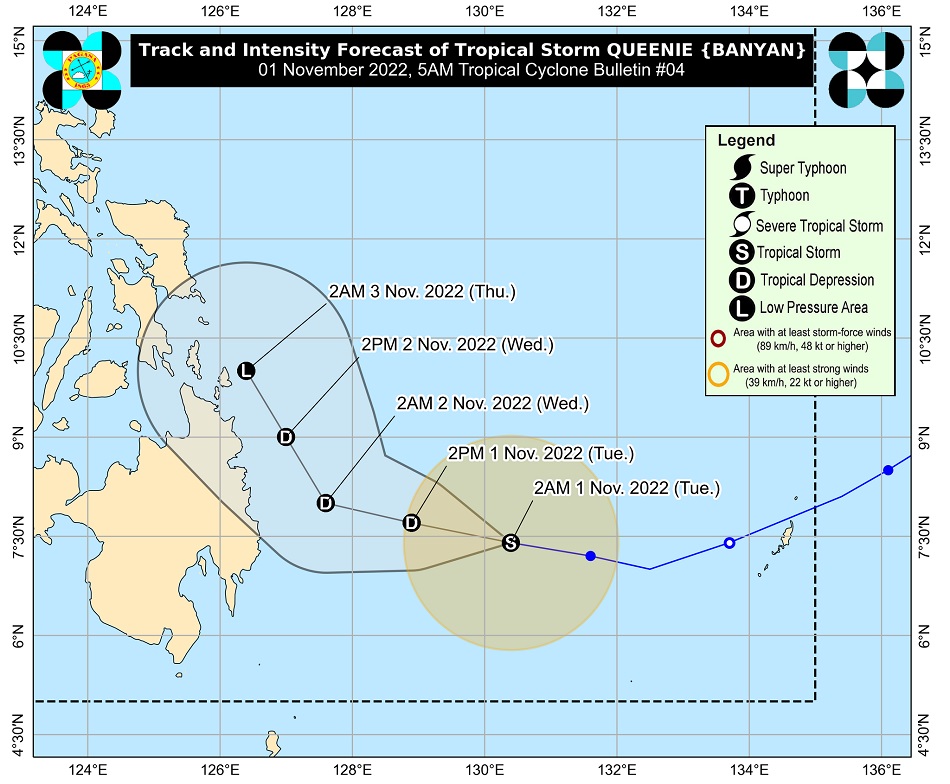
MANILA—Tropical storm Queenie is projected to bring rain showers in several areas in Mindanao, state weather bureau PAGASA said Tuesday early morning.
In its 5 a.m. weather bulletin, PAGASA said Queenie was last sighted 490 km east of Davao City packing maximum sustained winds of 65 kph near the center with 80 kph gusts.
PAGASA said that on Tuesday night through Wednesday, moderate to heavy rains are possible over Surigao del Norte, Surigao del Sur, and Dinagat Islands.
Light to moderate with at times heavy rains were also projected in Eastern Visayas, Davao Oriental, and the rest of Caraga Region.
ADVERTISEMENT
On Thursday, light to moderate with at times heavy rains may also fall in Caraga, Davao Region, Northern Mindanao, Eastern Visayas, Central Visayas, and Bicol Region.
"Under these conditions, flooding and rain-induced landslides are possible, especially in areas that are highly or very highly susceptible to these hazard as identified in hazard maps and in localities with significant antecedent rainfall," PAGASA said.
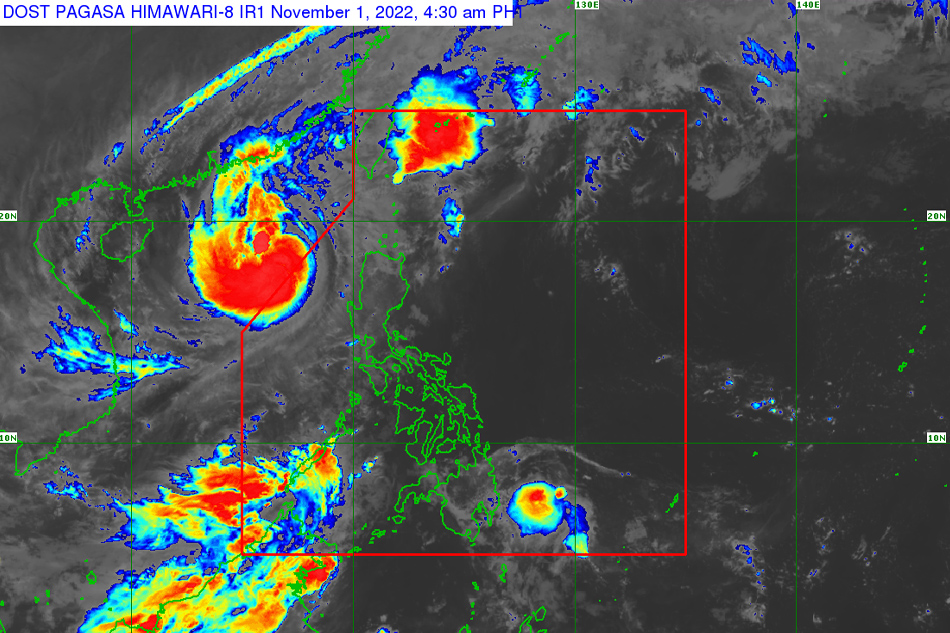
PAGASA image
The weather agency said the hoisting of Tropical Cyclone Wind Signals is not ruled out over the eastern portion of Caraga and in some areas in Eastern Visayas.
"Per latest track and intensity forecast, the highest wind signal that will likely be hoisted is Wind Signal No. 1," it said.
Queenie is expected to weaken into a tropical depression, and expected to dissipate into a low-pressure area by Thursday.
Tropical cyclone Paeng last week severely hit many areas in the Philippines with floods and strong winds, leaving at least 98 dead, according to the national disaster agency.
Just over half of the fatalities were from a series of flash floods and landslides that destroyed villages in Mindanao last Friday.
ABS-CBN is the leading media and entertainment company in the Philippines, offering quality content across TV, radio, digital, and film. Committed to public service and promoting Filipino values, ABS-CBN continues to inspire and connect audiences worldwide.
Our website is made possible by displaying online
advertisements to our visitors. Please consider supporting
us by disabling your ad blocker on our website.
Our website is made possible by displaying online
advertisements to our visitors. Please consider supporting
us by disabling your ad blocker on our website.