Welcome, Kapamilya! We use cookies to improve your browsing experience. Continuing to use this site means you agree to our use of cookies. Tell me more!
Storm Paeng changes track, threatens Southern, Central Luzon
Storm Paeng changes track, threatens Southern, Central Luzon
ABS-CBN News
Published Oct 27, 2022 06:59 PM PHT
|
Updated Oct 28, 2022 01:00 AM PHT
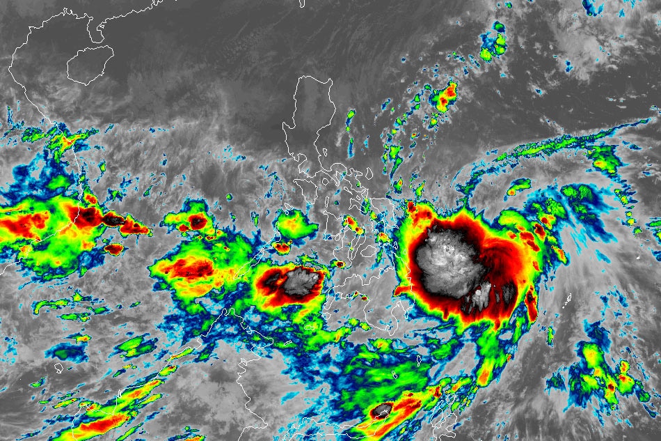
Tropical storm Paeng. RAMMB/Himawari 8
Signal. no 1 up in more Luzon, Visayas areas
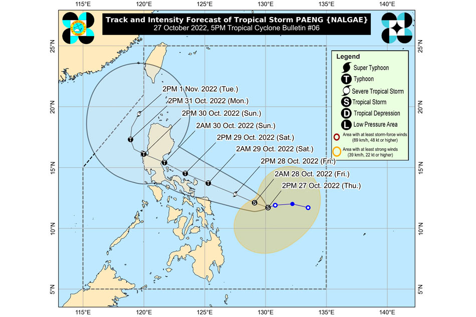
MANILA — Tropical storm Paeng has changed track and is now threatening Central and Southern Luzon, state weather bureau PAGASA said Thursday afternoon.
PAGASA earlier predicted that Paeng might hit Cagayan in the northern Philippines.
"On the forecast track, Paeng may pass close to Catanduanes on Saturday and a landfall scenario is possible on Sunday in the eastern coast of Aurora or Quezon," the state weather bureau said in its 5 p.m. bulletin Thursday.
The tropical cyclone is expected to further intensify and become a typhoon by Saturday, October 29.
ADVERTISEMENT
"Rapid intensification" in the next 72 hours is not ruled out, PAGASA said.
Because of the southward shift in Paeng's forecast track, PAGASA is not discounting a possible landfall in the eastern portion of the Bicol region.
PAGASA photo
Paeng was last spotted 510 kilometers east of Borongan City, Eastern Samar at 4 p.m., with sustained winds of 65 kilometers per hour and up to 80 kph gusts.
PAGASA raised Tropical Cyclone Wind Signal No. 1 in the following areas, where 39 to 61 kph winds are expected in 36 hours.
LUZON
Eastern Camarines Sur (Siruma, Tinambac, Goa, Lagonoy, Garchitorena, Caramoan, Presentacion, Saglay, San Jose, Tigaon, Ocampo, Iriga City, Buhi, Nabua, Bato, Balatan, Bula, Baao, Pili, Calabanga, Bombon, Magarao, Naga City, Milaor, Minalabac, San Fernando, Gainza, Camaligan, Canaman)
Catanduanes
Albay
Sorsogon
Masbate including Ticao Island and Burias Island
VISAYAS
Eastern Samar
Northern Samar
Samar
Biliran
Northern Leyte (San Isidro, Calubian, Tabango, Leyte, Capoocan, Carigara, Barugo, San Miguel, Babatngon, Tacloban City, Alangalang, Santa Fe, Palo)
PAGASA said the shear line and the trough or extension of Paeng will bring heavy rains over Visayas, most of Southern Luzon, and the northern portion of Mindanao.
On Friday early morning through evening, PAGASA said moderate to heavy with at times torrential rains are likely over Bicol region, Eastern Visayas, while light to moderate with at times heavy rains can be expected over Mimaropa, BARMM, Zamboanga Peninsula, Northern Mindanao, Caraga, Quezon, Cagayan, Isabela, Apayao, Aurora, and the rest of Visayas.
By Friday night through Saturday, PAGASA warned of heavy to torrential rains over the Bicol region, Northern Samar, Marinduque, and Quezon, while moderate to heavy with at times intense rains are possible over Metro Manila, Western Visayas, Aurora, Bulacan, Mindoro Provinces, Romblon, the eastern portions of Cagayan and Isabela, and the rest of Eastern Visayas and Calabarzon.
Meanwhile, light to moderate with at times heavy rains may lash Cordillera Administrative Region, Zamboanga Peninsula, BARMM, and the rest of Visayas, Cagayan Valley, Central Luzon, and MIMAROPA.
"Under these conditions, flooding and rain-induced landslides are expected," PAGASA said.
ABS-CBN is the leading media and entertainment company in the Philippines, offering quality content across TV, radio, digital, and film. Committed to public service and promoting Filipino values, ABS-CBN continues to inspire and connect audiences worldwide.
Our website is made possible by displaying online
advertisements to our visitors. Please consider supporting
us by disabling your ad blocker on our website.
Our website is made possible by displaying online
advertisements to our visitors. Please consider supporting
us by disabling your ad blocker on our website.