Typhoon Quinta exits PAR, brewing storm east of S. Luzon looms | ABS-CBN


ADVERTISEMENT

Welcome, Kapamilya! We use cookies to improve your browsing experience. Continuing to use this site means you agree to our use of cookies. Tell me more!
Typhoon Quinta exits PAR, brewing storm east of S. Luzon looms
Typhoon Quinta exits PAR, brewing storm east of S. Luzon looms
ABS-CBN News
Published Oct 27, 2020 11:56 AM PHT
|
Updated Oct 27, 2020 06:54 PM PHT
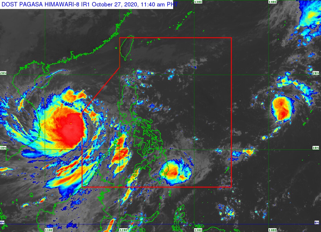
MANILA - Typhoon Quinta (international name: Molave) left the Philippine area of responsibility (PAR) on Tuesday morning, the Philippine state weather bureau said as Vietnam prepared for its approach.
MANILA - Typhoon Quinta (international name: Molave) left the Philippine area of responsibility (PAR) on Tuesday morning, the Philippine state weather bureau said as Vietnam prepared for its approach.
The country's 17th storm this year left PAR at 8 a.m. after inundating large swaths of Luzon, leaving at least 2 dead, and displacing some 150,000 persons.
The country's 17th storm this year left PAR at 8 a.m. after inundating large swaths of Luzon, leaving at least 2 dead, and displacing some 150,000 persons.
Quinta was last estimated 775 kilometers west of Calapan City, Oriental Mindoro as of 10 a.m., moving west at 20kph while packing maximum winds of 150 kph near the center and gusts of up to 185 kph, PAGASA said.
Quinta was last estimated 775 kilometers west of Calapan City, Oriental Mindoro as of 10 a.m., moving west at 20kph while packing maximum winds of 150 kph near the center and gusts of up to 185 kph, PAGASA said.
Tropical cyclone warning signal no. 1 remains hoisted over Kalayaan Islands, where 30-60 kph winds may rip roofs off nipa and cogon huts, damage rice crops and down banana plants.
Tropical cyclone warning signal no. 1 remains hoisted over Kalayaan Islands, where 30-60 kph winds may rip roofs off nipa and cogon huts, damage rice crops and down banana plants.
ADVERTISEMENT
A low pressure area located at 2,115 km east of Southern Luzon is likely to develop into tropical depression Rolly and enter the PAR in the next 48 hours, it added.
A low pressure area located at 2,115 km east of Southern Luzon is likely to develop into tropical depression Rolly and enter the PAR in the next 48 hours, it added.
On Tuesday, Quinta will bring moderate to heavy with at times intense rains over Western Visayas, Occidental Mindoro, Oriental Mindoro, Palawan including Calamian, Cuyo, and Kalayaan Islands, the bureau said.
On Tuesday, Quinta will bring moderate to heavy with at times intense rains over Western Visayas, Occidental Mindoro, Oriental Mindoro, Palawan including Calamian, Cuyo, and Kalayaan Islands, the bureau said.
Light to moderate with at times heavy rains will prevail over Calabarzon, Davao region, Cagayan, Isabela, Aurora, and Surigao del Sur, it added.
Light to moderate with at times heavy rains will prevail over Calabarzon, Davao region, Cagayan, Isabela, Aurora, and Surigao del Sur, it added.
PAGASA also warned against flooding and rain-induced landslides during heavy or prolonged rainfall especially in areas that are highly susceptible to these hazards.
PAGASA also warned against flooding and rain-induced landslides during heavy or prolonged rainfall especially in areas that are highly susceptible to these hazards.
Visit the ABS-CBN Weather Center for more updates.
ADVERTISEMENT
ADVERTISEMENT