Welcome, Kapamilya! We use cookies to improve your browsing experience. Continuing to use this site means you agree to our use of cookies. Tell me more!
Another storm to enter PAR; to bring rains over extreme N. Luzon Saturday
Another storm to enter PAR; to bring rains over extreme N. Luzon Saturday
ABS-CBN News
Published Oct 13, 2022 12:33 PM PHT
|
Updated Oct 13, 2022 05:29 PM PHT
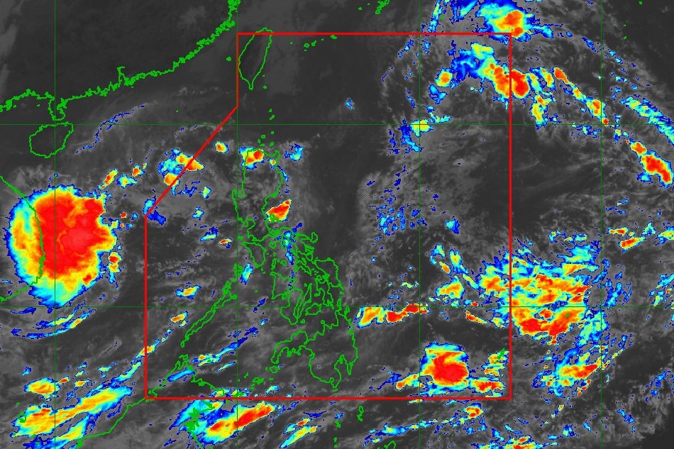
This PAGASA photo shows a tropical depression outside the Philippine area of responsibility at 11 a.m. Thursday, Oct. 13, 2022
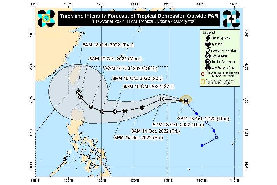
MANILA — Another storm is set to enter the Philippine area of responsibility (PAR) on Thursday and may lash the extreme northern Luzon this weekend, according to state weather bureau PAGASA.
"The passage of this tropical cyclone over Extreme Northern Luzon may bring heavy rainfall over the area beginning Saturday," the weather forecaster said in its 11 a.m. bulletin
"The tropical cyclone may also bring rough to very rough seas over the northern and eastern seaboards of Luzon beginning late Friday (14 October) or Saturday. Such condition may be risky for those using small seacrafts," it also said.
The tropical depression still outside PAR was 1,400 kilometers east of extreme northern Luzon at 10 a.m., moving north-northwestward at 25 kph.
ADVERTISEMENT
It was packing maximum sustained winds of 45 kph near the center and up to 55 kph gusts.
PAGASA photo
PAGASA said the tropical depression could still strengthen into a tropical storm as it moves over the Philippine Sea.
It added that "further intensification prior to its close approach to Extreme Northern Luzon is not ruled out."
The cyclone will be given the local name "Neneng" once it enters the Philippine area.
Based on the weather agency's forecast models, there is a "high likelihood" that wind signals will be raised over Batanes and several provinces in northern Luzon, with signal no. 2 being the highest possible wind signal.
ABS-CBN is the leading media and entertainment company in the Philippines, offering quality content across TV, radio, digital, and film. Committed to public service and promoting Filipino values, ABS-CBN continues to inspire and connect audiences worldwide.
Our website is made possible by displaying online
advertisements to our visitors. Please consider supporting
us by disabling your ad blocker on our website.
Our website is made possible by displaying online
advertisements to our visitors. Please consider supporting
us by disabling your ad blocker on our website.