Welcome, Kapamilya! We use cookies to improve your browsing experience. Continuing to use this site means you agree to our use of cookies. Tell me more!
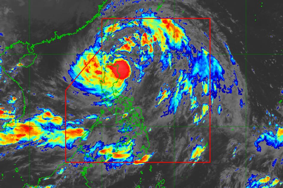
MANILA - Heavy rains are still expected to fall in northern Luzon even as severe tropical storm Maring is projected to leave the Philippine area of responsibility Tuesday morning, the state weather bureau said Monday evening.
In its 5 p.m weather bulletin, PAGASA said Maring (international name: Kompasu) was last located 105 kilometers east northeast of Aparri, Cagayan, packing maximum sustained winds of 95 kph near the center with 115 kph gusts while moving westward at 20 kph.
PAGASA said strong winds were extending 850 km from the storm's center.
Signal No. 2 was hoisted over the following areas, which could experience damaging gale-force to storm-force winds within 24 hours:
ADVERTISEMENT
Batanes
Cagayan including Babuyan Islands
Northern portion of Isabela (Palanan, Divilacan, Maconacon, Ilagan City, Tumauini, Cabagan, San Pablo, Santa Maria, Santo Tomas, Delfin Albano, Quirino, Gamu, Roxas, Mallig, Quezon)
Apayao
Kalinga
Mountain Province
Abra, Ilocos Norte
Ilocos Sur
Signal No. 1, which warns of strong winds prevailing within 36 hours, is raised in:
Rest of Isabela
Nueva Vizcaya
Quirino
Ifugao
Benguet
La Union
Pangasinan
Aurora
Nueva Ecija
Tarlac, Zambales
Pampanga
Bulacan
Northern portion of Bataan (Samal, Morong, Dinalupihan, Abucay, Orani, Hermosa)
Northern portion of Quezon (General Nakar, Infanta) including Polillo Islands, and Calaguas Islands
From PAGASA
Maring is expected to bring on Monday heavy to intense with at times torrential rains over Batanes, northern portion of mainland Cagayan including Babuyan Islands, Ilocos Norte, Ilocos Sur, Apayao, Abra, Mountain Province, and Benguet.
Moderate to heavy with at times intense rains will be experienced in the rest of mainland Cagayan, Cordillera Administrative Region, and Ilocos Region, while light to moderate with at times heavy rains will fall in Central Luzon and the rest of Cagayan Valley.
PAGASA warned of scattered flash floods and rain-induced landslides in affected areas.
Due to the influence of the southwest monsoon enhanced by Maring, the weather agency said monsoon rains are possible over the Visayas, Zamboanga Peninsula, Palawan, Occidental Mindoro, and Oriental Mindoro in the next 24 hours.
The weather disturbance is projected to continue moving westward over the Luzon Strait until Tuesday early morning before leaving the PAR.
PAGASA said it may intensify into a typhoon while moving over the West Philippine Sea.
The agency's next weather bulletin will be issued at 8 p.m. Monday.
ABS-CBN is the leading media and entertainment company in the Philippines, offering quality content across TV, radio, digital, and film. Committed to public service and promoting Filipino values, ABS-CBN continues to inspire and connect audiences worldwide.
Our website is made possible by displaying online
advertisements to our visitors. Please consider supporting
us by disabling your ad blocker on our website.
Our website is made possible by displaying online
advertisements to our visitors. Please consider supporting
us by disabling your ad blocker on our website.