Welcome, Kapamilya! We use cookies to improve your browsing experience. Continuing to use this site means you agree to our use of cookies. Tell me more!
Wind signals still up, as typhoon Henry set to leave Philippine area
Wind signals still up, as typhoon Henry set to leave Philippine area
ABS-CBN News
Published Sep 03, 2022 08:13 AM PHT
|
Updated Sep 03, 2022 09:34 AM PHT
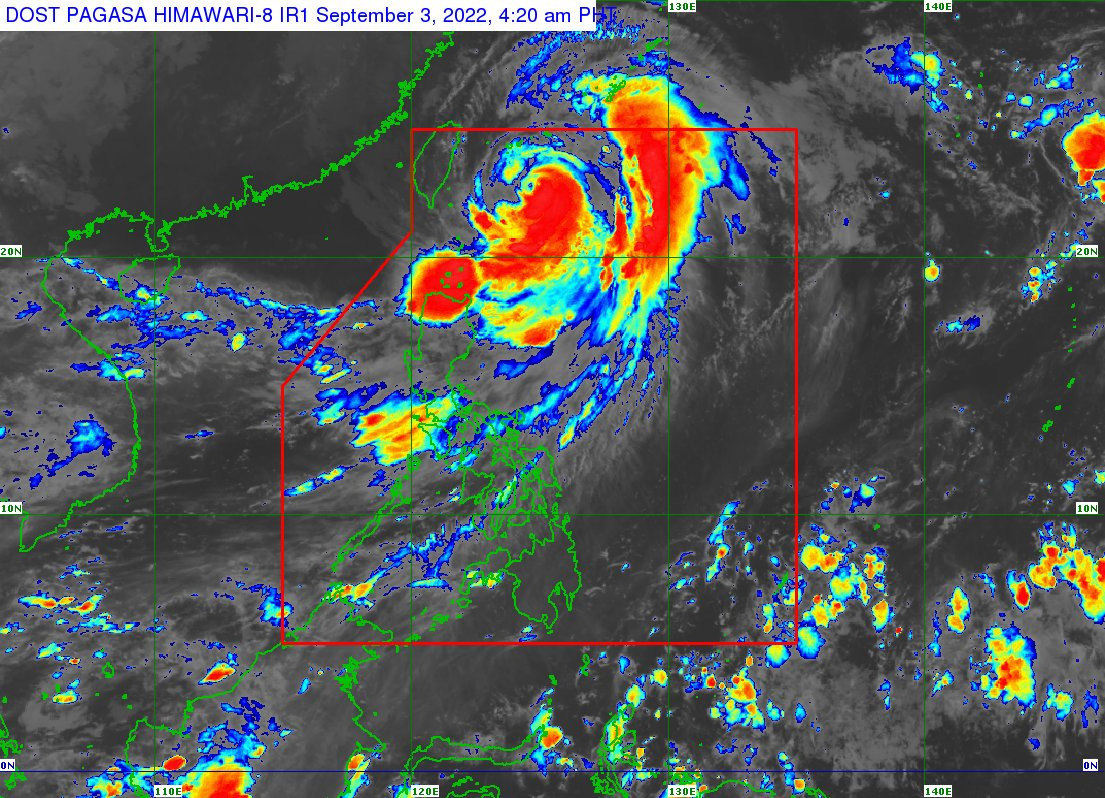
This PAGASA photo shows the location of Typhoon Henry at 4:20 a.m. Saturday, September 3, 2022.
MANILA — Tropical cyclone wind signals are still up over some northern Luzon areas as Typhoon Henry is expected to leave the Philippine area of responsibility Saturday night or Sunday morning, state weather bureau PAGASA said.
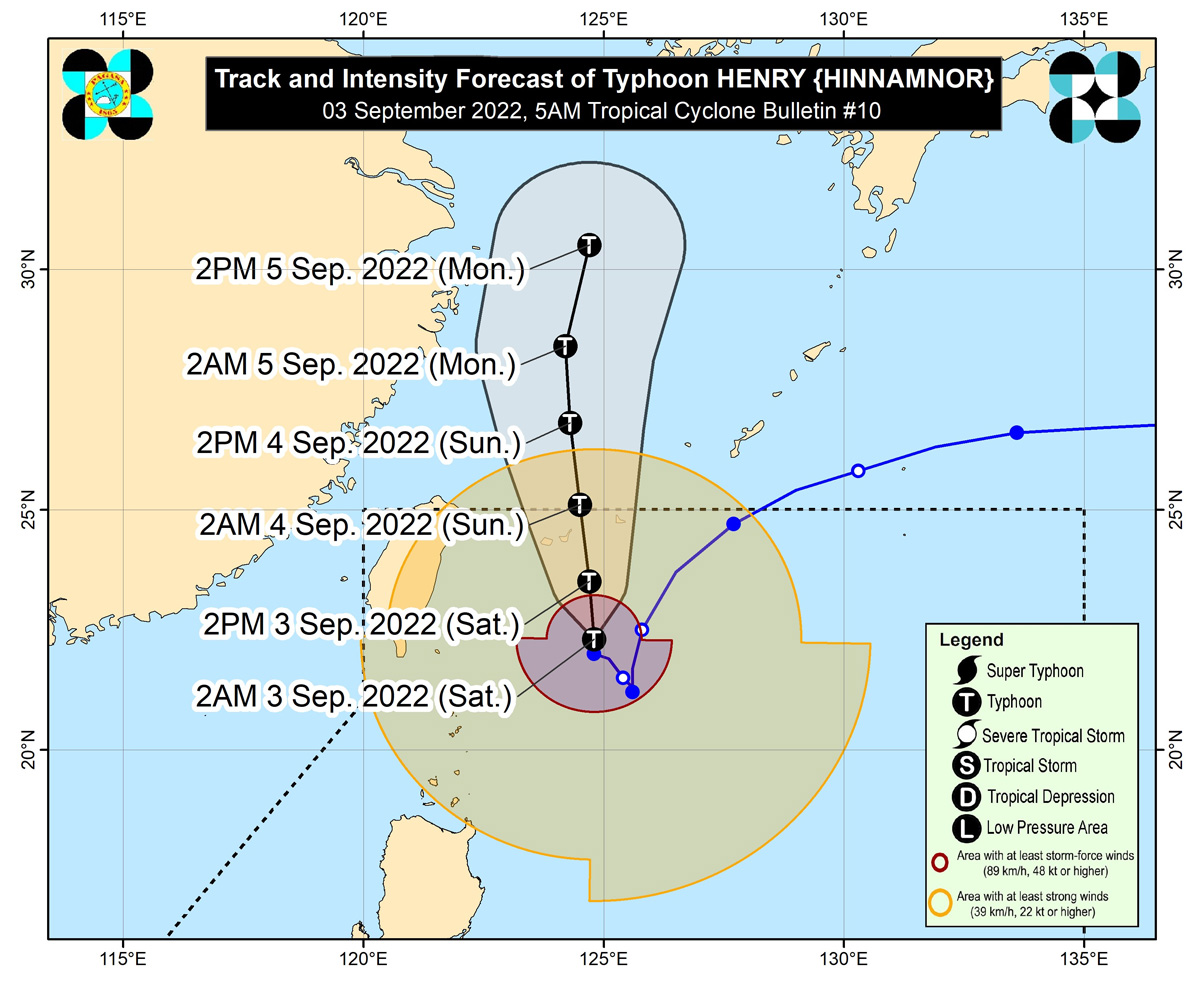
Signal no. 2 was raised over Batanes, while signal no. 1 was hoisted over Babuyan Islands and the northeastern portion of mainland Cagayan (Santa Ana). In its 4 a.m. bulletin, PAGASA warned of stormy weather conditions — with moderate to heavy rains — in these areas in the next 24 hours.
Cloudy skies with scattered rain showers and thunderstorms can also be expected over Metro Manila, Ilocos Region, the rest of Cagayan Valley, Cordillera Administrative Region, Central Luzon, Calabarzon, and Occidental Mindoro due to the trough or extension of Henry and southwest monsoon or habagat.
Localized thunderstorms, meanwhile, may bring partly cloudy to cloudy skies with isolated rain showers or thunderstorms over the rest of the country, according to PAGASA.
ADVERTISEMENT
PAGASA photo
Henry was sighted 360 kilometers east northeast of Itbayat, Batanes, as of 5 a.m. Saturday. It is packing maximum sustained winds of 150 kph near the center and gustiness of up to 185 kph.
Moving northward "slowly," PAGASA said Henry will continue to gradually accelerate northward throughout the weekend before turning north-northeastward on Monday.
A slight intensification may still occur as Henry leaves the Philippine area (i.e., over the East China Sea), it also said.
ABS-CBN is the leading media and entertainment company in the Philippines, offering quality content across TV, radio, digital, and film. Committed to public service and promoting Filipino values, ABS-CBN continues to inspire and connect audiences worldwide.
Our website is made possible by displaying online
advertisements to our visitors. Please consider supporting
us by disabling your ad blocker on our website.
Our website is made possible by displaying online
advertisements to our visitors. Please consider supporting
us by disabling your ad blocker on our website.