Welcome, Kapamilya! We use cookies to improve your browsing experience. Continuing to use this site means you agree to our use of cookies. Tell me more!
Typhoon may leave PH area of responsibility tonight
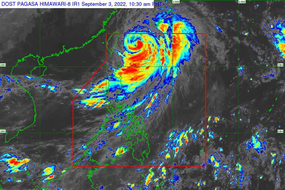
MANILA (UPDATE) — Typhoon Henry moved further north of the country on Saturday while maintaining its strength, with the southwest monsoon expected to bring rains in parts of Luzon, the state weather bureau said on Saturday.
The eye of country's eighth storm this year was last spotted 405 kilometers Northeast of Itbayat town, Batanes and was moving northward at 15 kilometers per hour (kph), PAGASA's 11 a.m. bulletin showed.
Henry is packing maximum sustained winds of 150 kph near the center with gusts of up to 185 kph.
Wind Signal no. 2 is still up in Batanes, according to the weather agency.
ADVERTISEMENT
Babuyan Islands and the northeastern portion of mainland Cagayan (Santa Ana), meanwhile, are under Wind Signal no. 1.
"Tropical cyclone winds may reach gale-force strength in any areas where Wind Signal no. 2 is hoisted and strong wind strength (strong breeze to near gale) will be experienced within any of the areas where Wind Signal no. 1 is currently in effect," PAGASA said.
Because the storm enhanced the southwest monsoon or Hanging Habagat, monsoon rains will be experienced over the western sections of Northern and Central Luzon, based on the latest bulletin.
Henry, PAGASA said, is expected to leave the Philippine area of responsibility on Saturday night but a "slight intensification" may happen as it leaves the area.
The storm is also forecast to move generally northward this weekend.
"On the track forecast, the typhoon may pass very close or make landfall in the southern islands of the Ryukyu Archipelago tonight," said the weather bureau.
YELLOW WARNING
PAGASA already issued a yellow rainfall warning over Bataan and Zambales due to the bad weather. This means flood-prone areas are at risk.
Light to moderate with occasional heavy rains, meanwhile, are expected to prevail over Cavite, Batangas, Rizal, Laguna and Nueva Ecija in the next three hours, the agency said.
Metro Manila, Bulacan, Tarlac, Pampanga, and nearby areas, meanwhile, may experience light to moderate with occasional heavy rains in the next three hours.
The weather bureau urged localities and disaster monitoring offices to monitor the situation due to the hazards that comes with the continuous pouring of rain.
A National Disaster Risk Reduction and Management Council (NDRRMC) monitoring noted that 5 people from Cagayan Valley have been preemptively evacuated because of the storm.
The disaster response monitoring agency has also yet to report any injuries or deaths due to the typhoon but it earlier said some P600 million in government funds is on standby for response.
ABS-CBN is the leading media and entertainment company in the Philippines, offering quality content across TV, radio, digital, and film. Committed to public service and promoting Filipino values, ABS-CBN continues to inspire and connect audiences worldwide.
Our website is made possible by displaying online
advertisements to our visitors. Please consider supporting
us by disabling your ad blocker on our website.
Our website is made possible by displaying online
advertisements to our visitors. Please consider supporting
us by disabling your ad blocker on our website.