Welcome, Kapamilya! We use cookies to improve your browsing experience. Continuing to use this site means you agree to our use of cookies. Tell me more!
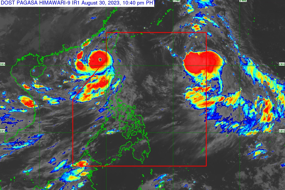
MANILA (UPDATED) - Super typhoon Goring (international name: Saola) has exited the Philippine area of responsibility as a new storm enters, the state weather bureau said late Wednesday.
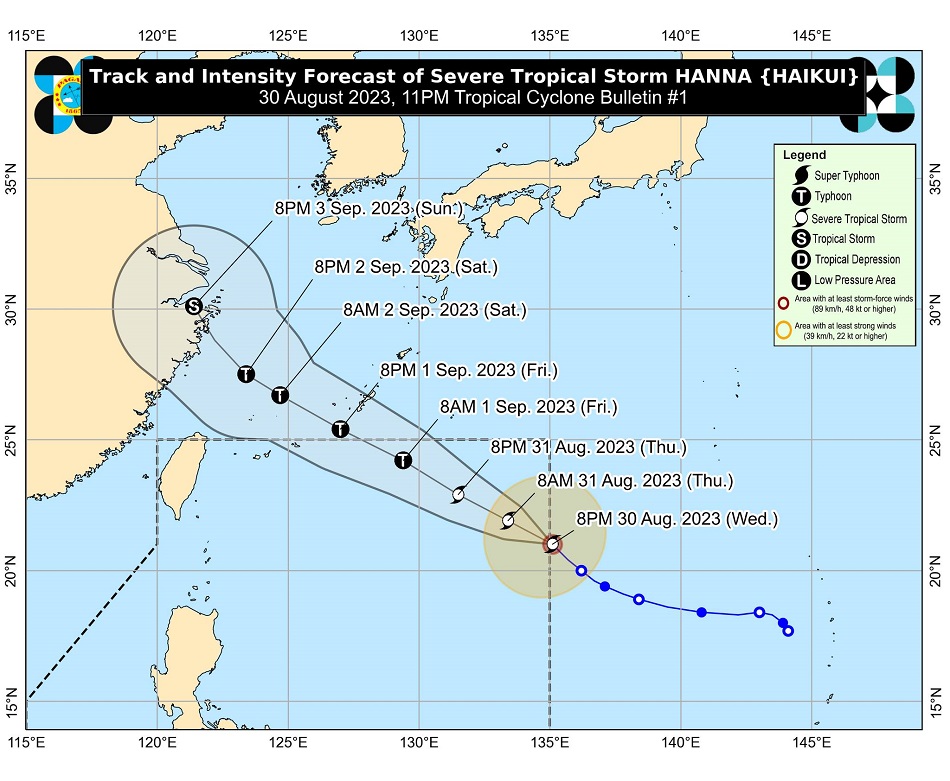
PAGASA said severe tropical storm Haikui entered PAR at 9 p.m. and was given the domestic name "Hanna".
As of 10 p.m., Hanna was last located 1,335 kilometers east of extreme northern Luzon, packing maximum sustained winds of 95 kilometers per hour near the center, with gusts of up to 115 kph.
It is currently moving northwestward at 15 kph, and is expected to remain far from the Philippine landmass.
ADVERTISEMENT
Although it is less likely to directly affect the country, PAGASA earlier said Hanna may enhance the habagat beginning Thursday, and may bring occasional or monsoon rains over the western portion of Luzon and Visayas.
Hanna is expected to exit PAR on Friday afternoon or evening.
Meanwhile, PAGASA has also lifted all tropical cyclone wind signals over the country. However, it still warned of heavy rains over Ilocos Norte, Ilocos Sur, Abra and the western portions of Pangasinan and Apayao, which may experience between 50 to 100 millimeters of rainfall until Thursday evening.
The enhanced southwest monsoon or habagat may also bring occasional or monsoon rains over the western portions of Luzon in the next three days.
The habagat will also continue bring gusty conditions over Ilocos Region, Cordillera Administrative Region, Zambales, Bataan, Aurora, Bulacan, Metro Manila, Calabarzon, Mimaropa, Bicol Region, Western Visayas, and the northern portion of Eastern Visayas until Friday.
ABS-CBN is the leading media and entertainment company in the Philippines, offering quality content across TV, radio, digital, and film. Committed to public service and promoting Filipino values, ABS-CBN continues to inspire and connect audiences worldwide.
Our website is made possible by displaying online
advertisements to our visitors. Please consider supporting
us by disabling your ad blocker on our website.
Our website is made possible by displaying online
advertisements to our visitors. Please consider supporting
us by disabling your ad blocker on our website.