Welcome, Kapamilya! We use cookies to improve your browsing experience. Continuing to use this site means you agree to our use of cookies. Tell me more!
LPA off Luzon now tropical depression Gardo; super typhoon may enter Wednesday
LPA off Luzon now tropical depression Gardo; super typhoon may enter Wednesday
Ariel Rojas and Rowegie Abanto,
ABS-CBN News
Published Aug 30, 2022 05:14 PM PHT
|
Updated Aug 30, 2022 06:33 PM PHT
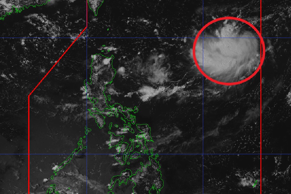
This photo shows the location of tropical depression Gardo at 2 p.m. Tuesday. PAGASA
MANILA — A low-pressure area (LPA) off northern Luzon developed into a tropical depression Gardo on Tuesday afternoon while a super typhoon may enter the Philippine area on Wednesday, state weather bureau PAGASA said.
Gardo was 1,195 kilometers east of extreme Northern Luzon at 3 p.m., packing maximum sustained winds of 55 kilometers per hour and 70 kph gusts, said PAGASA.
The storm's trough or extension will bring cloudy skies with scattered rains and thunderstorms in Aurora, Calabarzon, and Camarines Norte, said the weather bureau.
It said Metro Manila and the rest of the country will experience localized thunderstorms.
ADVERTISEMENT
Meanwhile, super typhoon Hinnamnor was still outside the Philippine area of responsibility (PAR) at 3 p.m., said PAGASA.
Spotted 1,510 kilometers east northeast of extreme northern Luzon, Hinnamnor was packing 185 kph maximum sustained winds and up to 230 kph gusts, the weather agency said.
Hinnamnor may enter PAR on Wednesday evening, Aug. 31, PAGASA said in its 11 a.m. advisory.
ABS-CBN is the leading media and entertainment company in the Philippines, offering quality content across TV, radio, digital, and film. Committed to public service and promoting Filipino values, ABS-CBN continues to inspire and connect audiences worldwide.
Our website is made possible by displaying online
advertisements to our visitors. Please consider supporting
us by disabling your ad blocker on our website.
Our website is made possible by displaying online
advertisements to our visitors. Please consider supporting
us by disabling your ad blocker on our website.