Welcome, Kapamilya! We use cookies to improve your browsing experience. Continuing to use this site means you agree to our use of cookies. Tell me more!
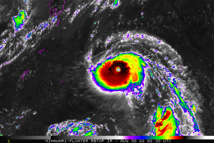
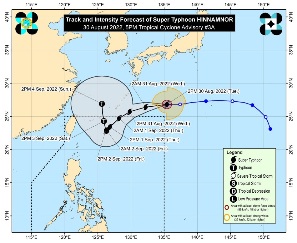
MANILA (UPDATED) — Super Typhoon Hinnamnor, a tropical cyclone off northeastern Luzon that may enter the Philippine area of responsibility (PAR) Wednesday evening, may still intensify, state weather bureau PAGASA said Tuesday.
Hinnamnor reached the super typhoon category at 2 p.m. Tuesday. It is the first super typhoon that may enter the PAR this year.
In its 5 p.m. bulletin, PAGASA said Hinnamnor, which was last spotted 1,485 kilometers east-northeast of extreme Northern Luzon, was packing 185 kph maximum sustained winds and up to 230 kph gusts.
According to PAGASA, the super typhoon may continue to intensify over the sea south of Japan and may reach a peak intensity of 195 kilometers per hour.
ADVERTISEMENT
Moving westward at 30 kph, Hinnamnor may enter the PAR region Wednesday evening, PAGASA said.
PAGASA image
But it said that "further deceleration is forecast to occur as it turns more southwestward over the northern Philippine Sea."
From Friday through Saturday, Hinnamnor may become almost stationary, the weather agency added.
PAGASA reiterated that it is not ruling out the possibility of hoisting tropical cyclone wind signals over extreme northern Luzon as Hinnamnor "may continue to expand in the coming days as it moves towards the northern Philippine Sea."
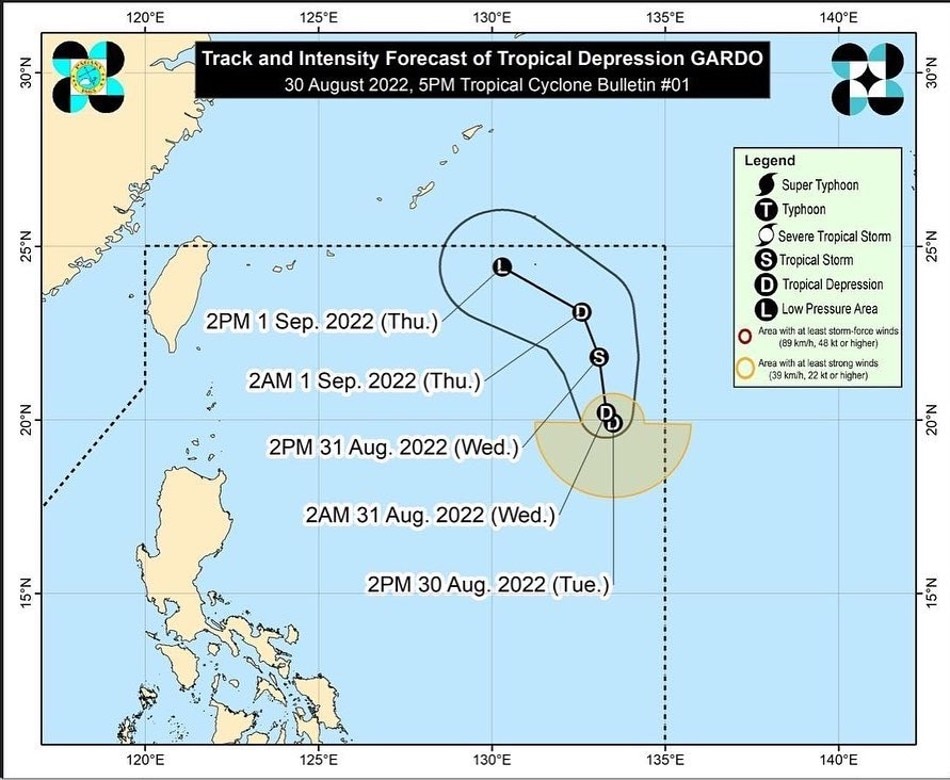
Meanwhile, Tropical Depression Gardo, which is inside the PAR, is unlikely to directly affect weather in the country, PAGASA said in its 5 p.m. advisory.
ADVERTISEMENT
The center of Tropical Depression Gardo was last potted 1,185 km east of extreme northern Luzon.
It is packing maximum sustained winds of 55 k[h near the center, gusts of up to 70 kph.
Tropical Depression Gardo and Super Typhoon Hinnamnor are not expected to hit land, according to PAGASA's forecast track Tuesday afternoon.
Gardo, however, will interact or merge with Hinnamnor, which will be called Henry once it enters the PAR.
ABS-CBN is the leading media and entertainment company in the Philippines, offering quality content across TV, radio, digital, and film. Committed to public service and promoting Filipino values, ABS-CBN continues to inspire and connect audiences worldwide.
Our website is made possible by displaying online
advertisements to our visitors. Please consider supporting
us by disabling your ad blocker on our website.
Our website is made possible by displaying online
advertisements to our visitors. Please consider supporting
us by disabling your ad blocker on our website.