Welcome, Kapamilya! We use cookies to improve your browsing experience. Continuing to use this site means you agree to our use of cookies. Tell me more!
PAGASA lifts all wind signals but rains to persist over western Luzon
PAGASA lifts all wind signals but rains to persist over western Luzon
Rowegie Abanto,
ABS-CBN News
Published Aug 24, 2022 12:05 PM PHT
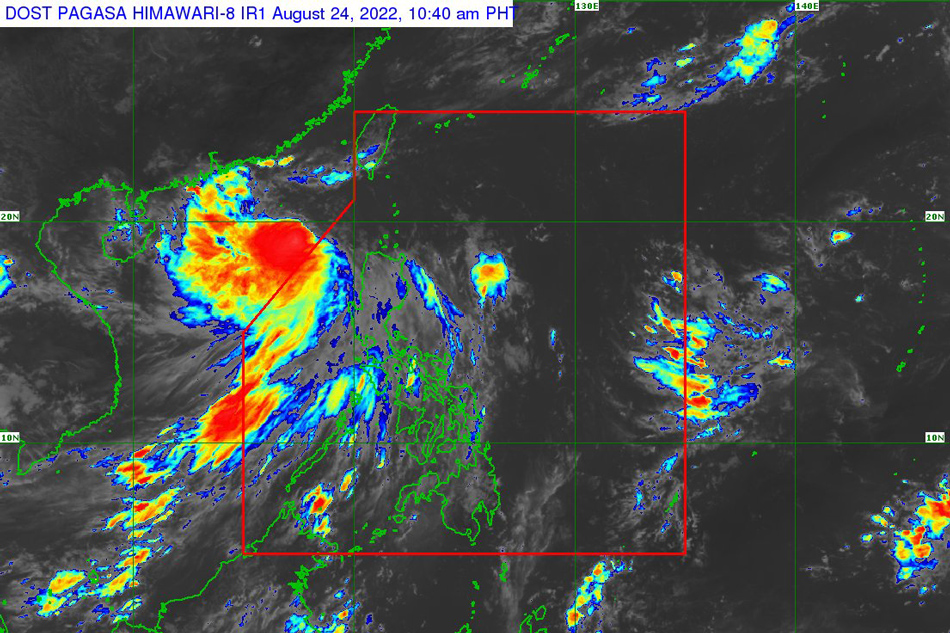
This PAGASA photo shows the location of storm Florita (international name: Ma-on) outside the PAR at 10:40 a.m. Wednesday.
MANILA — All tropical cyclone wind signals have been lifted over the Philippines, state weather bureau PAGASA said Wednesday, as severe tropical storm Florita (international name: Ma-on) slightly intensified outside the nation's area of responsibility.
Although wind signals are removed, the southwest monsoon or habagat may continue to bring rains over the western sections of Luzon in the next 24 hours, PAGASA said in its 11 a.m. advisory.
It added that gusts reaching strong breeze to near gale-force strength may still be experienced over Metro Manila, MIMAROPA, Cavite, Quezon, Bulacan, Pampanga, Pangasinan, Aurora, Ilocos Region, Cordillera Administrative Region, and Cagayan Valley.
PAGASA said Florita is forecast to move west-northwestward over the West Philippine Sea toward the southern portion of China, where it is expected to hit land Thursday morning or early afternoon.
ADVERTISEMENT
Florita, which has maximum sustained winds of 100 kilometers per hour and up to 125 kph gusts, is forecast to re-intensify and reach the typhoon category Wednesday night, according to the weather agency.
ABS-CBN is the leading media and entertainment company in the Philippines, offering quality content across TV, radio, digital, and film. Committed to public service and promoting Filipino values, ABS-CBN continues to inspire and connect audiences worldwide.
Our website is made possible by displaying online
advertisements to our visitors. Please consider supporting
us by disabling your ad blocker on our website.
Our website is made possible by displaying online
advertisements to our visitors. Please consider supporting
us by disabling your ad blocker on our website.