Welcome, Kapamilya! We use cookies to improve your browsing experience. Continuing to use this site means you agree to our use of cookies. Tell me more!
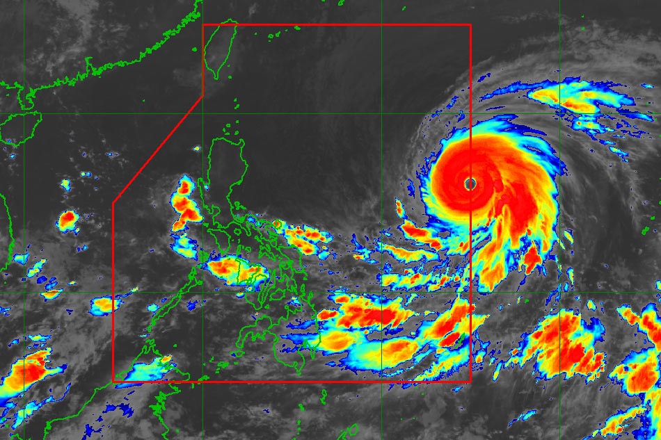
MANILA — Super typhoon Mawar has slightly weakened as it continued its advance toward the Philippine area of responsibility late Friday evening, state weather bureau PAGASA said.
In its 11 p.m. weather advisory, PAGASA said the center of Mawar was located 1,475 kilometers east of Central Luzon, packing maximum sustained winds of 205 kms. per hour near the center with 250 kph gusts.
PAGASA classifies a tropical cyclone with maximum wind speed exceeding 185 kph as super typhoon, while that with a speed of 118 to 184 kph falls within the typhoon category.
According to the weather bureau, strong to typhoon-force winds extend outwards up to 570 km from the center of the tropical cyclone.
ADVERTISEMENT
As Mawar is expected to enter the PAR on early Saturday morning, it is likely to move over the waters east of Batanes and may become almost stationary, then turn north-northeastward on Wednesday, said PAGASA.
Once it enters PAR, it will be given the local name "Betty."
"Mawar is forecast to remain as a super typhoon tonight until the weekend, although the chance of slight weakening still remains," the advisory read.
"However, this tropical cyclone may weaken at faster rate beginning on Monday during its slowdown period due to potential unfavorable conditions (e.g., effect of upwelling of cooler ocean water and dry air intrusion), although it is expected to remain as a typhoon by the end of the forecast period," it added.
Areas in northern Luzon may expect heavy rainfall on Monday through Wednesday, PAGASA said.
"In addition, strong to storm-force conditions may be experienced over Extreme Northern Luzon and the northeastern portion of mainland Northern Luzon, while strong to gale-force conditions are possible over the northern and eastern portions of Northern Luzon mainland. As a result, wind signals will be raised by tomorrow in anticipation of these severe winds," the agency said.
Mawar is also expected to enhance the southwest monsoon or habagat and bring rainy weather by early next week over broad swaths of the country.
ABS-CBN is the leading media and entertainment company in the Philippines, offering quality content across TV, radio, digital, and film. Committed to public service and promoting Filipino values, ABS-CBN continues to inspire and connect audiences worldwide.
Our website is made possible by displaying online
advertisements to our visitors. Please consider supporting
us by disabling your ad blocker on our website.
Our website is made possible by displaying online
advertisements to our visitors. Please consider supporting
us by disabling your ad blocker on our website.