Welcome, Kapamilya! We use cookies to improve your browsing experience. Continuing to use this site means you agree to our use of cookies. Tell me more!
Super typhoon Mawar slightly intensifies as it moves closer to PH
Super typhoon Mawar slightly intensifies as it moves closer to PH
ABS-CBN News
Published May 25, 2023 04:38 PM PHT
|
Updated May 25, 2023 07:49 PM PHT
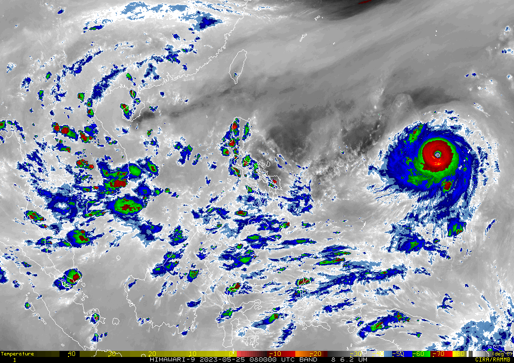
RAMMB/US NOAA/Himawari 8
Mawar could make close approach to Cagayan Valley
MANILA (2nd UPDATE) — After hammering Guam, super typhoon Mawar is still gaining strength as it moves closer to the Philippines, state weather bureau PAGASA said Thursday.
Mawar is now packing maximum sustained winds of up to 195 kilometers per hour near the center and 240 kph gusts, PAGASA said in its 4 p.m. bulletin. Earlier in the day, its winds topped 185 kph with 230 kph gusts.
It also accelerated at 15 kph and still followed a west-northwestward track.
The super typhoon was located 2,000 kilometers east of southeastern Luzon at 3 p.m., according to the weather bureau. It was forecast to enter the Philippine area of responsibility by Friday evening or Saturday morning, and will move toward the east coast of extreme northern Luzon. PAGASA said it was not ruling out a southward shift in Mawar's track.
ADVERTISEMENT
Authorities are now preparing for the possible effects of Mawar, which is expected to enhance the southwest monsoon or habagat and bring rainy weather by early next week over broad swaths of the country.
President Ferdinand Marcos Jr. said food packs and aid have already been prepositioned not only in the northern part of the country but in areas where Mawar's impact would be felt.
In a briefing, PAGASA weather specialist Daniel James Villamil said Mawar could make a close approach to Cagayan Valley, where torrential rains are expected because of the storm's rain bands.
"More in particular, pinakamaaapektuhan nito ang mga lalawigan sa extreme northern Luzon area. That includes Batanes, Babuyan Islands, as well as mainland Cagayan," he added.
The rainy weather might last for 3 days, Villamil said, which could start by Sunday until Tuesday next week.
ADVERTISEMENT
Mawar will be given the local name "Betty" once it enters the Philippine area.
WEATHER CONDITION
Super typhoon Mawar still has no direct effect on the nation's weather, as of Thursday afternoon.
But scattered rain showers and thunderstorms will be experienced over Palawan, Western Visayas, Northern Mindanao, SOCCSKSARGEN, Zamboanga Peninsula, and BARMM because of the southwesterly windflow, according to PAGASA.
Metro Manila and elsewhere could expect cloudy weather with occasional rain and thunderstorms, it added.
ABS-CBN is the leading media and entertainment company in the Philippines, offering quality content across TV, radio, digital, and film. Committed to public service and promoting Filipino values, ABS-CBN continues to inspire and connect audiences worldwide.
Our website is made possible by displaying online
advertisements to our visitors. Please consider supporting
us by disabling your ad blocker on our website.
Our website is made possible by displaying online
advertisements to our visitors. Please consider supporting
us by disabling your ad blocker on our website.