Welcome, Kapamilya! We use cookies to improve your browsing experience. Continuing to use this site means you agree to our use of cookies. Tell me more!
Paeng maintains strength, to bring heavy rains over Bicol region, Eastern Visayas
Paeng maintains strength, to bring heavy rains over Bicol region, Eastern Visayas
ABS-CBN News
Published Oct 27, 2022 11:38 PM PHT
|
Updated Oct 28, 2022 12:11 AM PHT
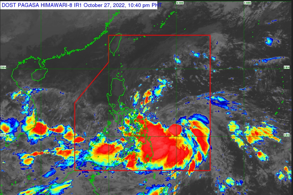
PAGASA
MANILA - Tropical storm Paeng maintained its strength as it moves westward slowly, state weather bureau PAGASA said Thursday night.
In its 11 p.m. weather bulletin, PAGASA said Paeng was last located 485 kilometers east of Borongan City, Eastern Samar, packing maximum sustained winds of 65 kilometers per hour (kph) near the center, with gusts of up to 80 kph.
It is currently moving west slowly, and is expected to bring moderate to heavy with at times intense rains likely over Bicol Region, Eastern Visayas Friday.
Light to moderate with at times heavy rains are also possible over Mimaropa, Bangsamoro Autonomous Region in Muslim Mindanao, Zamboanga peninsula, northern Mindanao, Caraga, Quezon, Cagayan, Isabela, Apayao, Aurora, and the rest of Visayas.
ADVERTISEMENT
By Saturday, heavy to torrential rains may prevail over the Bicol region, Northern Samar, Marinduque, and Quezon, while moderate to heavy with at times intense rains are possible over Metro Manila, Western Visayas, Aurora, Bulacan, Mindoro Provinces, Romblon, the eastern portions of Cagayan and Isabela, and the rest of Eastern Visayas and Calabarzon.
PAGASA raised Tropical Cyclone Wind Signal No. 1 in the following areas, where 39 to 61 kph winds are expected in 36 hours.
LUZON
Catanduanes
Albay
Sorsogon
Masbate including Ticao and Burias Islands
Camarines Sur
Eastern portion of Romblon (San Fernando, Cajidiocan, Magdiwang, Romblon, Corcuera, Banton), Marinduque, Camarines Norte, Polillo Islands
Southern portion of mainland Quezon (Atimonan, Padre Burgos, Pagbilao, Quezon, Alabat, Perez, Unisan, Gumaca, Plaridel, Agdangan, Macalelon, Pitogo, General Luna, Catanauan, San Francisco, San Andres, Mulanay, San Narciso, Buenavista, Lopez, Calauag, Guinayangan, Tagkawayan, Mauban)
VISAYAS
Eastern Samar
Northern Samar
Samar
Biliran
Northern portion of Leyte (San Isidro, Calubian, Tabango, Leyte, Capoocan, Carigara, San Miguel, Babatngon, Tacloban City, Santa Fe, Palo, Villaba, Kananga, Jaro, Alangalang, Pastrana, Dagami, Tanauan, Tabontabon, Tolosa, Tunga, Barugo)
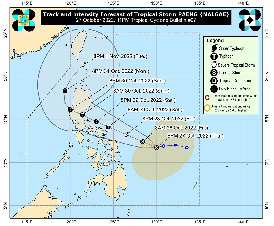
Forecast track of Tropical Storm Paeng. PAGASA
Paeng is expected to move west northwestward over the Philippine Sea through Sunday whil moving towards the central or southern portion of Luzon.
PAGASA said Paeng may make landfall or pass very close to Catanduanes on Saturday. Another landfall scenario is also possible on Sunday over Aurora or the east coast of Quezon.
Paeng is also expected to further intensify while moving over the Philippine Sea, and may reach severe tropical storm category within 24 hours, and into a typhoon by Saturday.
PAGASA earlier said Paeng has changed its track, after it was forecast to hit Cagayan in the northern Philippines.
ABS-CBN is the leading media and entertainment company in the Philippines, offering quality content across TV, radio, digital, and film. Committed to public service and promoting Filipino values, ABS-CBN continues to inspire and connect audiences worldwide.
Our website is made possible by displaying online
advertisements to our visitors. Please consider supporting
us by disabling your ad blocker on our website.
Our website is made possible by displaying online
advertisements to our visitors. Please consider supporting
us by disabling your ad blocker on our website.