Welcome, Kapamilya! We use cookies to improve your browsing experience. Continuing to use this site means you agree to our use of cookies. Tell me more!
LPA off Eastern Visayas develops into tropical depression Paeng
LPA off Eastern Visayas develops into tropical depression Paeng
ABS-CBN News
Published Oct 26, 2022 11:35 AM PHT
|
Updated Oct 26, 2022 12:48 PM PHT
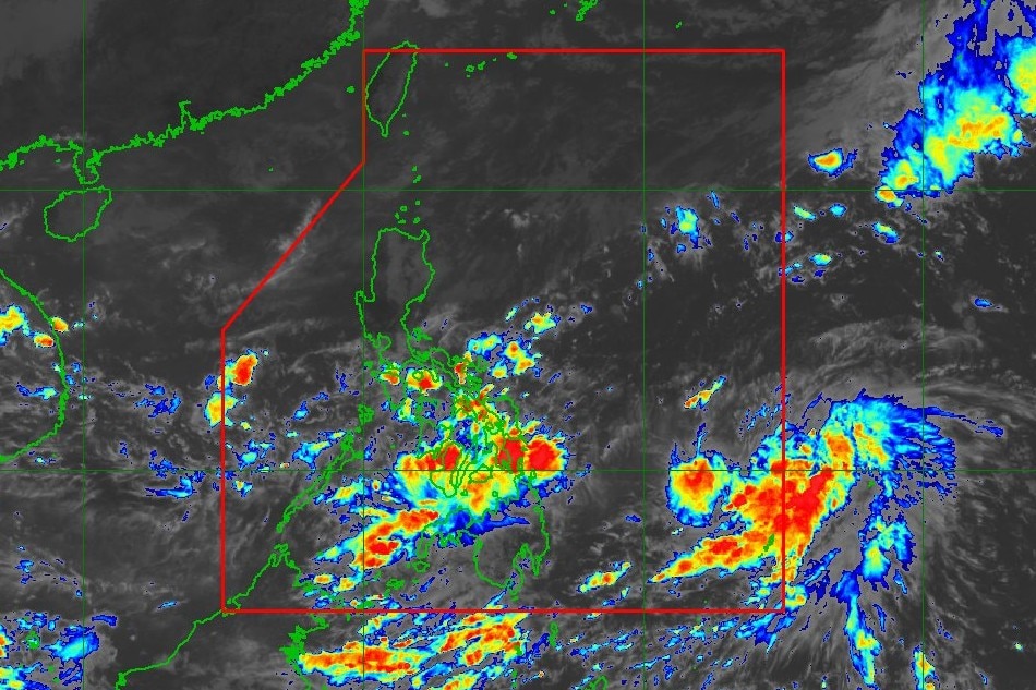
This image shows tropical depression Paeng at 11:10 a.m. Wednesday. PAGASA
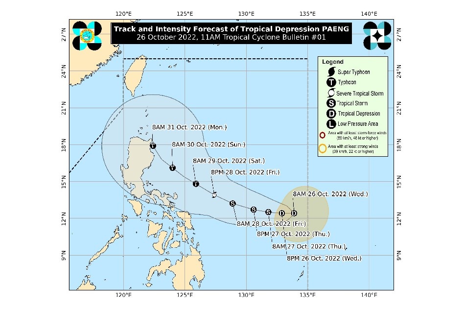
MANILA (UPDATED) — A low pressure area off eastern Visayas developed into tropical depression Paeng on Wednesday morning and would stir rains over parts of the country, PAGASA said.
In the next 24 hours, Paeng's trough or extension and a shear line will bring heavy rains over Quezon, Bicol region, Visayas, and the northern and western portions of Mindanao, the state weather bureau said in its 11 a.m. advisory.
"Under these conditions, flooding and rain-induced landslides are likely," it warned.
Paeng was 855 kilometers east of Eastern Visayas at 10 a.m., moving west-northwestward slowly, PAGASA said.
ADVERTISEMENT
It was packing maximum sustained winds of 45 kilometers per hour near the center and up to 55 kph gusts.
Bad weather has forced the cancellation of classes in some areas on Wednesday.
Paeng is predicted to intensify into a tropical storm on Thursday, the weather agency said.
"Further intensification is likely while moving over the Philippine Sea and may reach typhoon category on Saturday."
A typhoon packs winds of up to 184 kph and no. 4 is the highest wind signal.
ADVERTISEMENT
PAGASA said wind signals may be raised for some Eastern Visayas and Bicol Region areas on Thursday morning "at the earliest."
Based on the forecast track, the tropical cyclone may pass close to Northern Luzon on Sunday or Monday, PAGASA said. It is not discounting a landfall scenario over the area.
From Friday morning through Saturday, PAGASA said heavy to intense with at times torrential rains are possible over Bicol Region, while moderate to heavy with at times intense rains may lash Eastern Visayas, Mindoro Provinces, Marinduque, Romblon, Quezon, Aurora, Isabela, and Cagayan.
Light to moderate with at times heavy rains can be expected over Rizal, Laguna, Nueva Ecija, Bulacan, Cordillera Administrative Region, and the rest of Visayas and Cagayan Valley, it said.
By Saturday morning through Sunday, heavy to intense with at times torrential rains may occur in Cagayan, Isabela, Apayao, and the northern portion of Aurora, while moderate to heavy with at times intense rains over Ilocos Norte, and the rest of Aurora, Cagayan Valley, and Cordillera Administrative Region, according to the weather agency.
ADVERTISEMENT
It added that light to moderate with at times heavy rains are possible over Western Visayas and the rest of Luzon.
ABS-CBN is the leading media and entertainment company in the Philippines, offering quality content across TV, radio, digital, and film. Committed to public service and promoting Filipino values, ABS-CBN continues to inspire and connect audiences worldwide.
Our website is made possible by displaying online
advertisements to our visitors. Please consider supporting
us by disabling your ad blocker on our website.
Our website is made possible by displaying online
advertisements to our visitors. Please consider supporting
us by disabling your ad blocker on our website.