Welcome, Kapamilya! We use cookies to improve your browsing experience. Continuing to use this site means you agree to our use of cookies. Tell me more!
Ofel changes track, makes 4th landfall over Marinduque
Ofel changes track, makes 4th landfall over Marinduque
ABS-CBN News
Published Oct 15, 2020 12:10 AM PHT
|
Updated Oct 15, 2020 03:01 AM PHT
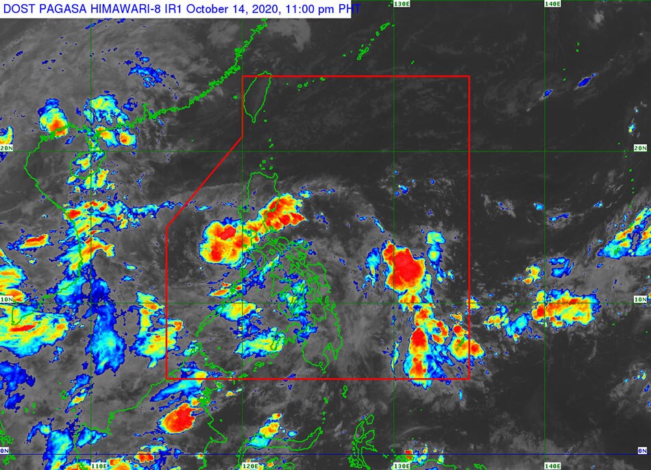
PAGASA said weather system Ofel changed track and made landfall over Marinduque Wednesday night. PAGASA Facebook page
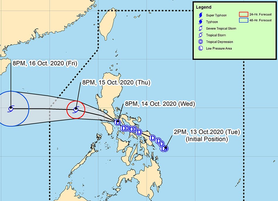
MANILA— Tropical depression "Ofel" changed track Wednesday night, and made its fourth landfall over Marinduque, state weather bureau PAGASA said.
PAGASA said Ofel made landfall over Torrijos, Marinduque at 7:45 p.m.
It made its third landfall over Burias Island Wednesday noon, after making its second landfall over Matnog in Sorsogon at 6:00 a.m., and its initial landfall in Can-avid, Eastern Samar at 2:30 a.m.
According to PAGASA's latest weather bulletin, Ofel's center was estimated 55 kilometers northeast of Calapan City, Oriental Mindoro at 10 p.m., packing maximum sustained winds of 45 kilometers per hour and gusts of up to 55 kph.
ADVERTISEMENT
It is now moving northwestward at 30 kph.
The storm is forecast to move west-northwestward or northwestward between Wednesday night and Thursday morning, passing close or over Batangas or the northern portion of the Mindoro provinces, before emerging over the West Philippines Sea.
Ofel is also forecast to remain a tropical depression within the next 12 to 24 hours, but may intensify into a tropical storm while over the West Philippine Sea.
Ofel will bring moderate to heavy rains over Metro Manila, Cavite, Laguna, Rizal, the northern portion of Quezon, Aurora, Bataan and Bulacan, PAGASA said.
Nueva Vizcaya, Quirino, and the rest of Central Luzon and Calabarzon will experience light to moderate rains, with at times heavy rains, because of the storm, while Mimaropa, Western Visayas, Central Visayas and most of Mindanao will have similar weather conditions due to the southwest monsoon, according to PAGASA.
The weather bureau warned of possible flooding, flashfloods and rain-induced landslides during heavy or prolonged rainfall in areas susceptible to these hazards.
Tropical cyclone wind signal (TCWS) No. 1 was raised in the following areas of Luzon, where 30 to 60 kph winds may rip roofs off nipa and cogon huts, damage rice crops, and down banana plants:
Batangas
Laguna
Cavite
Rizal
Quezon
Metro Manila
Bataan
Calamian Islands
Occidental Mindoro
Oriental Mindoro
Marinduque
Romblon
Camarines Norte
the western portion of Camarines Sur(Cabusao,Libmanan,Pamplona,Pasacao,Sipocot,Lupi,Ragay,Del Gallego)
Burias Island
The weather agency expects Ofel to leave the Philippine area of responsibility by Friday.
ABS-CBN is the leading media and entertainment company in the Philippines, offering quality content across TV, radio, digital, and film. Committed to public service and promoting Filipino values, ABS-CBN continues to inspire and connect audiences worldwide.
Our website is made possible by displaying online
advertisements to our visitors. Please consider supporting
us by disabling your ad blocker on our website.
Our website is made possible by displaying online
advertisements to our visitors. Please consider supporting
us by disabling your ad blocker on our website.