LOOK: Typhoon Paeng seen from space | ABS-CBN


Welcome, Kapamilya! We use cookies to improve your browsing experience. Continuing to use this site means you agree to our use of cookies. Tell me more!
LOOK: Typhoon Paeng seen from space
LOOK: Typhoon Paeng seen from space
ABS-CBN News
Published Sep 26, 2018 02:27 AM PHT
A German astronaut on Wednesday posted photos of typhoon Paeng (international name Trami) seen from space.
A German astronaut on Wednesday posted photos of typhoon Paeng (international name Trami) seen from space.
The photos were uploaded online by European Space Agency (ESA) astronaut Alexander Gerst, as seen from the International Space Station.
The photos were uploaded online by European Space Agency (ESA) astronaut Alexander Gerst, as seen from the International Space Station.
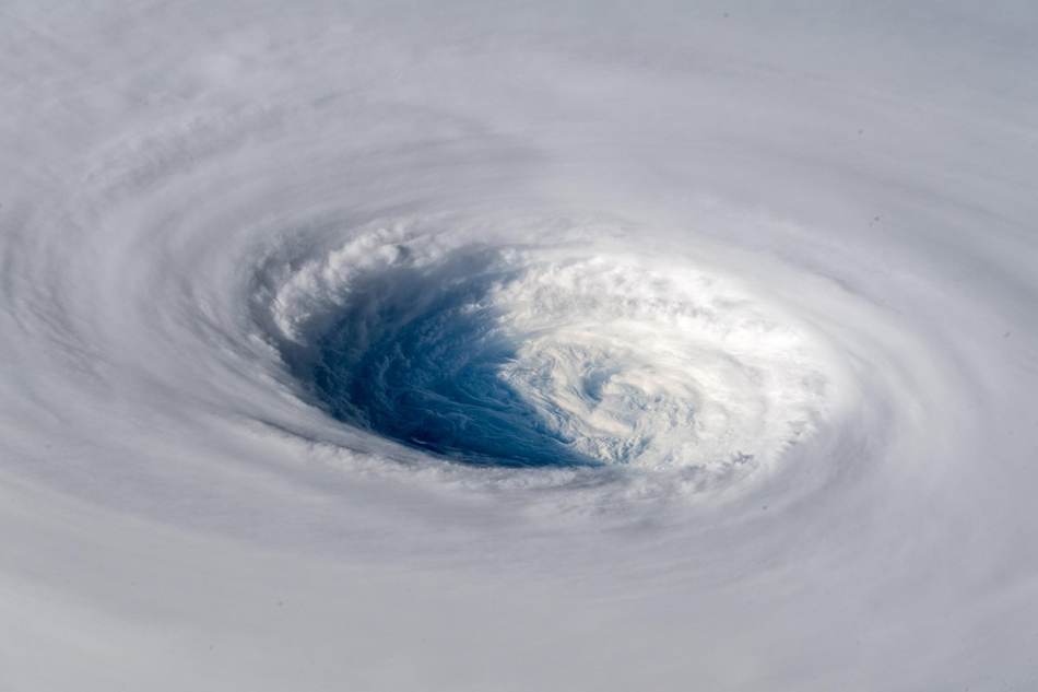
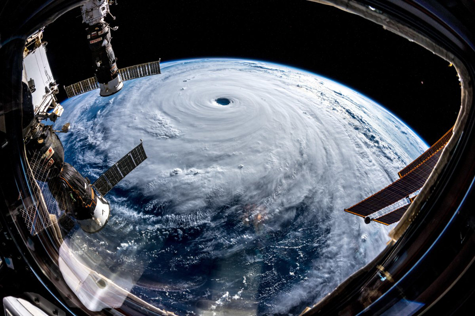
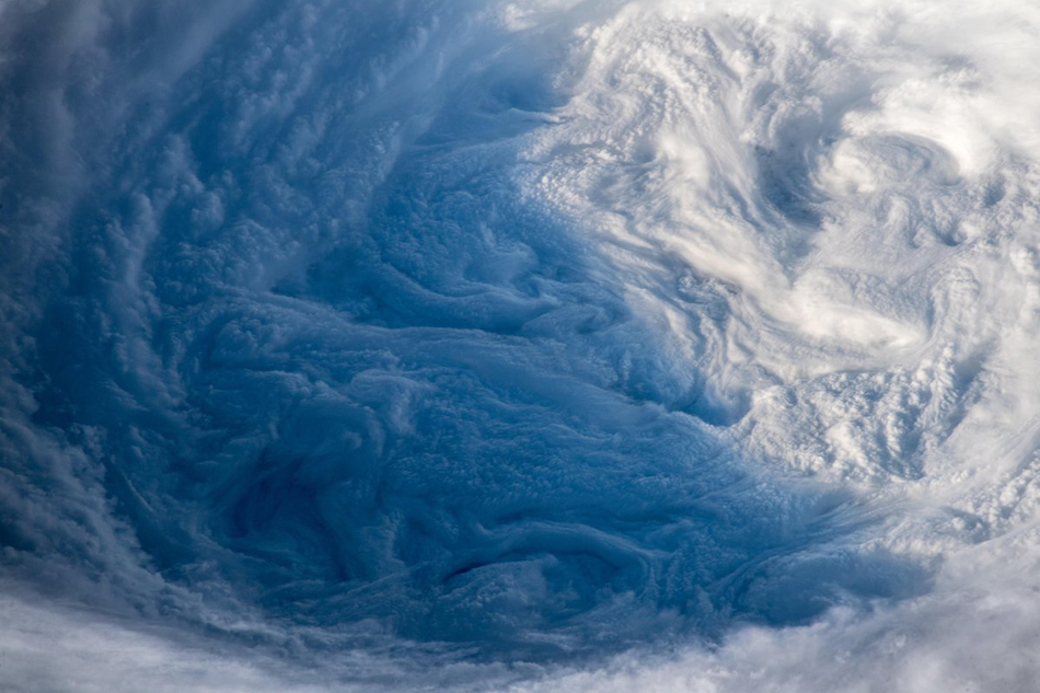
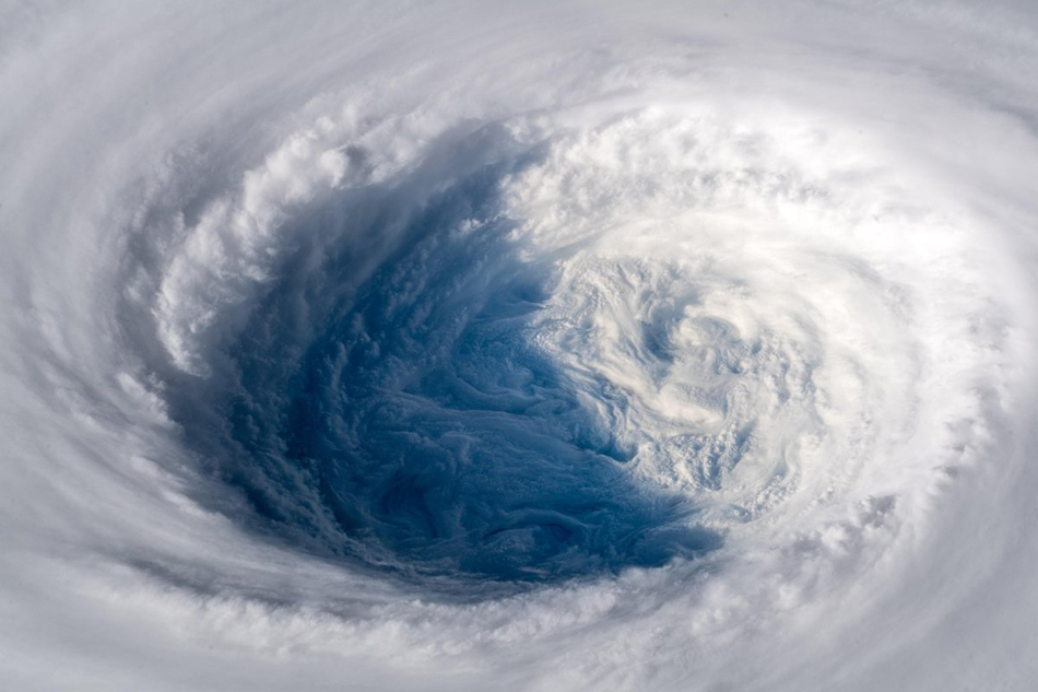
"As if somebody pulled the planet's gigantic plug. Staring down the eye of yet another fierce storm. Category 5 Super Typhoon Trami is unstoppable and heading for Japan and Taiwan. Be safe down there! #TyphoonTrami," Gerst said on Twitter.
"As if somebody pulled the planet's gigantic plug. Staring down the eye of yet another fierce storm. Category 5 Super Typhoon Trami is unstoppable and heading for Japan and Taiwan. Be safe down there! #TyphoonTrami," Gerst said on Twitter.
Three of the photos show close-up views of typhoon Paeng's eye, while another shows its size as seen from the ISS.
Three of the photos show close-up views of typhoon Paeng's eye, while another shows its size as seen from the ISS.
ADVERTISEMENT
The U.S. Navy and Air Force's Joint Typhoon Warning Center in Hawaii has classified Paeng as a super typhoon, equivalent to a Category 5 hurricane in the western hemisphere.
The U.S. Navy and Air Force's Joint Typhoon Warning Center in Hawaii has classified Paeng as a super typhoon, equivalent to a Category 5 hurricane in the western hemisphere.
It is currently packing sustained winds of 240 kilometers per hour and gusts reaching 296 kph in 1-minute mean readings, according to JTWC's latest bulletin early Wednesday.
It is currently packing sustained winds of 240 kilometers per hour and gusts reaching 296 kph in 1-minute mean readings, according to JTWC's latest bulletin early Wednesday.
The tropical cyclone is not expected to make landfall in the Philippines but could bring rains by Friday over disaster-hit northern Luzon, according to state weather bureau PAGASA.
The tropical cyclone is not expected to make landfall in the Philippines but could bring rains by Friday over disaster-hit northern Luzon, according to state weather bureau PAGASA.
ADVERTISEMENT
ADVERTISEMENT