Welcome, Kapamilya! We use cookies to improve your browsing experience. Continuing to use this site means you agree to our use of cookies. Tell me more!
Super typhoon to stir monsoon rains over Luzon: PAGASA
Super typhoon to stir monsoon rains over Luzon: PAGASA
Benise Balaoing,
ABS-CBN News
Published Aug 31, 2022 12:38 PM PHT
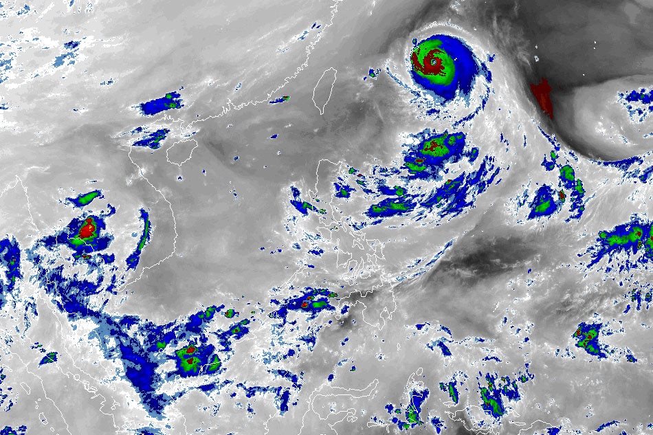
AMMB/US NOAA/Himawari 8
MANILA — Super typhoon Hinnamnor may enhance the southwest monsoon or habagat and dump rains over parts of Luzon this week, state weather bureau PAGASA said Wednesday.
Hinnmanor was 980 kilometers northeast of extreme northern Luzon at 10 a.m. It was packing maximum sustained winds of 195 kilometers per hour near the center and up to 240 kph gusts, PAGASA said.
Moving west southwestward at 30 kph, Hinnamnor may enter the Philippine Area of Responsibility (PAR) on Wednesday night and will be named Henry, said the weather bureau.
By late Thursday through Friday, Hinnamnor may become almost stationary, said PAGASA.
ADVERTISEMENT
Light to moderate with at times heavy rains associated with the super typhoon's outermost rainbands may affect extreme northern Luzon from late Thursday or Friday, according to state meteorologists.
"This tropical cyclone may enhance the southwest monsoon and bring monsoon rains over the western section of Luzon beginning on Friday," PAGASA added.
Tropical cyclone wind signals may also be raised in some areas in northern Luzon, it said.
Meanwhile, tropical depression Gardo may merge with Hinnamnor on Wednesday afternoon or evening, PAGASA said.
At 10 a.m., Gardo 1,065 km east of extreme Northern Luzon, packing 55 kph maximum sustained winds and 70 kph gusts.
It is unlikely to directly affect the weather condition in the country, PAGASA said.
ABS-CBN is the leading media and entertainment company in the Philippines, offering quality content across TV, radio, digital, and film. Committed to public service and promoting Filipino values, ABS-CBN continues to inspire and connect audiences worldwide.
Our website is made possible by displaying online
advertisements to our visitors. Please consider supporting
us by disabling your ad blocker on our website.
Our website is made possible by displaying online
advertisements to our visitors. Please consider supporting
us by disabling your ad blocker on our website.