Welcome, Kapamilya! We use cookies to improve your browsing experience. Continuing to use this site means you agree to our use of cookies. Tell me more!
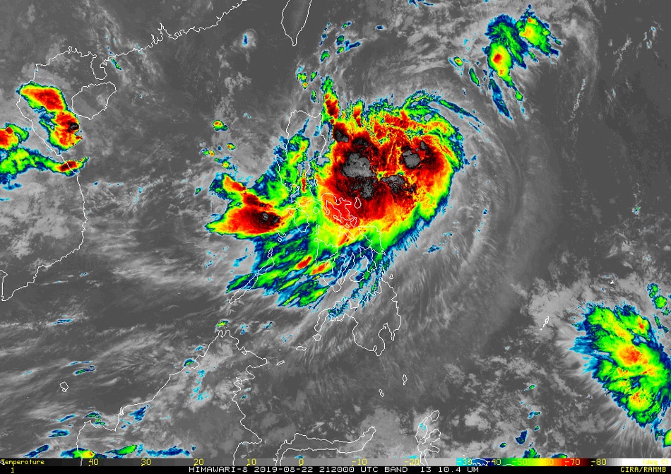
MANILA (UPDATE)—Tropical cyclone Ineng has intensified into a severe tropical storm Friday, state weather bureau PAGASA said.
As of 10 a.m., Ineng was last spotted 500 kilometers east northeast of Tuguegarao City, Cagayan, moving north northwest at 25 km per hour and packing maximum sustained winds of 95 kph and gusts of up to 115 kph.
Tropical cyclone wind signal number 2, which could bring 60 to 120 kph winds within 24 hours, was still hoisted over Batanes.
Cagayan, including Babuyan Group of Islands, Isabela, Apayao, Kalinga, northern Abra and Ilocos Norte remain under signal number 1, which could experience 30 to 60 kph winds within 36 hours.
ADVERTISEMENT
Ineng and the southwest monsoon will bring moderate to heavy rains over Batanes, Cagayan (including Babuyan Islands), Ilocos Norte and Apayao, PAGASA said.
Light to moderate with intermittent heavy monsoon rains will affect Metro Manila, Zambales, Bataan, Cavite, Batangas, Mindoro Provinces, northern portions of Palawan (including Calamian and Cuyo Islands), Aklan, Antique, and the rest of Ilocos Region, Cordillera Administrative Region and Cagayan Valley.
PAGASA warned residents at risk of landslide and flood to take precautionary measures and coordinate with their respective local disaster risk reduction and management offices.
Sea travel also remains risky over the eastern seaboards of Luzon and Visayas due to potentially rough sea conditions, the agency added.
Ineng is expected to exit the Philippine area of responsibility (PAR) on Saturday night.
ABS-CBN is the leading media and entertainment company in the Philippines, offering quality content across TV, radio, digital, and film. Committed to public service and promoting Filipino values, ABS-CBN continues to inspire and connect audiences worldwide.
Our website is made possible by displaying online
advertisements to our visitors. Please consider supporting
us by disabling your ad blocker on our website.
Our website is made possible by displaying online
advertisements to our visitors. Please consider supporting
us by disabling your ad blocker on our website.