'Carina' leaves PAR, continues to affect Luzon | ABS-CBN


ADVERTISEMENT

Welcome, Kapamilya! We use cookies to improve your browsing experience. Continuing to use this site means you agree to our use of cookies. Tell me more!
'Carina' leaves PAR, continues to affect Luzon
'Carina' leaves PAR, continues to affect Luzon
ABS-CBN News
Published Aug 01, 2016 10:59 AM PHT
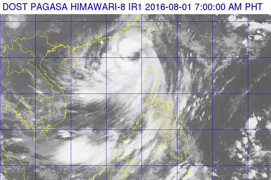
WEATHER WATCH: Severe tropical storm "Carina" has left the Philippine area of responsibility (PAR) but will continue affecting parts of Luzon, state meteorologists said Monday morning.
WEATHER WATCH: Severe tropical storm "Carina" has left the Philippine area of responsibility (PAR) but will continue affecting parts of Luzon, state meteorologists said Monday morning.
In its 8 a.m. bulletin, weather bureau PAGASA said northwestern parts of Luzon will continue to experience direct effects of the storm as it pushes northwestward at 24 kilometers per hour (kph).
In its 8 a.m. bulletin, weather bureau PAGASA said northwestern parts of Luzon will continue to experience direct effects of the storm as it pushes northwestward at 24 kilometers per hour (kph).
Bearing winds of up to 103 kph near the center and gusts of up to 135 kph, Carina will bring moderate to heavy rains within its 250-kilometer diameter.
Bearing winds of up to 103 kph near the center and gusts of up to 135 kph, Carina will bring moderate to heavy rains within its 250-kilometer diameter.
Public storm signal number remained hoisted in Ilocos Norte, Northern Cagayan including Babuyan Group of Islands, Apayao. Abra, and Ilocos Sur.
Public storm signal number remained hoisted in Ilocos Norte, Northern Cagayan including Babuyan Group of Islands, Apayao. Abra, and Ilocos Sur.
ADVERTISEMENT
PAGASA said it may lift all storm signals by 11 a.m.
PAGASA said it may lift all storm signals by 11 a.m.
But areas south of the storm will still experience occasionally heavy rain given enhanced effects of the southwest monsoon.
But areas south of the storm will still experience occasionally heavy rain given enhanced effects of the southwest monsoon.
Eastern parts of the country can expect improved weather within the day.
Eastern parts of the country can expect improved weather within the day.
ADVERTISEMENT
ADVERTISEMENT