Welcome, Kapamilya! We use cookies to improve your browsing experience. Continuing to use this site means you agree to our use of cookies. Tell me more!
Fabian now outside PH but heavy monsoon rains continue to drench Luzon, W. Visayas
Aleta Nieva Nishimori,
ABS-CBN News
Published Jul 24, 2021 08:33 AM PHT
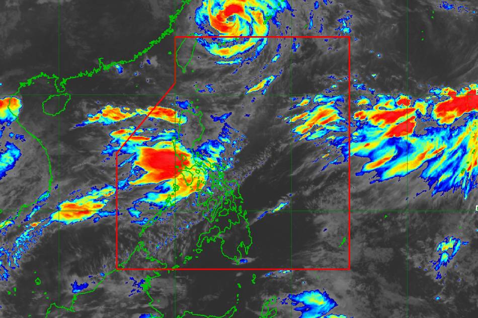
PAGASA
MANILA— Typhoon Fabian is now outside the Philippine area of responsibility but heavy rains may still be experienced in most parts of Luzon, including Metro Manila, and in some portions of Western Visayas in the next 24 hours due to the southwest monsoon, state weather bureau PAGASA said Saturday.
“Ganap na alas-11 kagabi ay tuluyan nang lumabas ng ating area of responsibility si bagyong Fabian,” said weather specialist Loriedin de la Cruz.
(Typhoon Fabian exited our area of responsibility at 11 p.m.)
De la Cruz said Fabian remains under typhoon category, packing maximum sustained winds of 140 kilometers per hour near the center and gustiness of up to 170 kph.
ADVERTISEMENT
As of its 5 a.m. weather bulletin, PAGASA said Fabian is moving northward at 15 kph.
All tropical wind cyclone wind signals have been lifted.
But since Fabian is at the country's northern portion, its position is still very favorable to enhance the southwest monsoon, said De la Cruz.
“Ang southwest monsoon nakakaapekto pa rin 'yan sa malaking bahagi ng ating bansa. Halos buong bansa pa rin apektado ng habagat. Dahil d'yan ang mga pag-ulan, asahan pa rin natin sa malaking bahagi ng ating kalupaan,” De la Cruz said.
(The southwest monsoon is still affecting a big portion of our country. Almost the entire country is affected by the habagat. Because of that a big portion of our landmass will experience rains.)
ADVERTISEMENT
She added that Fabian remained inside PAR for 8 days. While it did not make landfall, it enhanced the habagat, causing heavy rains across the country.
PAGASA said the typhoon-enhanced habagat is expected to bring heavy rains in the next 24 hours to Ilocos Region, the Cordillera Administrative Region, Metro Manila, most of Central Luzon, Calabarzon, and Mimaropa and portions of Western Visayas.
Under this condition, PAGASA said rough to very rough seas will be experienced over the seaboards of Luzon and the western and central seaboards of Visayas.
“Sea travel is risky for small seacraft over these waters. Mariners without the proper experience should immediately seek safe harbor,” PAGASA said.
Moderate to rough seas will prevail over the remaining seaboards of the country.
ADVERTISEMENT
Meanwhile, PAGASA said another tropical storm (international name: Nepartak) is being monitored outside the Philippine boundary. The tropical storm was last spotted 2,855 kilometers east northeast of extreme Northern Luzon.
“Mababa ang tiyansa na pumasok pa ito sa ating area of responsibility at wala naman tayong nakikitang significant effect nito sa anumang bahagi ng ating kalupaan,” said De la Cruz.
(It has a low chance of entering our PAR and we don’t see any significant effect to any part of the country.)
ABS-CBN is the leading media and entertainment company in the Philippines, offering quality content across TV, radio, digital, and film. Committed to public service and promoting Filipino values, ABS-CBN continues to inspire and connect audiences worldwide.
Our website is made possible by displaying online
advertisements to our visitors. Please consider supporting
us by disabling your ad blocker on our website.
Our website is made possible by displaying online
advertisements to our visitors. Please consider supporting
us by disabling your ad blocker on our website.