Welcome, Kapamilya! We use cookies to improve your browsing experience. Continuing to use this site means you agree to our use of cookies. Tell me more!
Typhoon Betty lingers over Batanes; habagat to bring rains over Metro Manila
Typhoon Betty lingers over Batanes; habagat to bring rains over Metro Manila
ABS-CBN News
Published May 31, 2023 08:02 AM PHT
|
Updated May 31, 2023 06:39 PM PHT
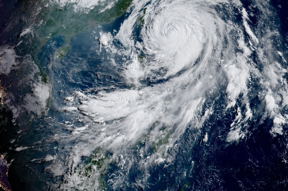
Typhoon Betty continues to move east of Batanes. Imagery courtesy of the Japanese Meteorological Agency
MANILA (UPDATED) — Typhoon Betty kept its strength and sped up as it moved over the sea northeast of Batanes before noon on Wednesday, while the habagat threatened to bring rains in some parts of the country, state weather bureau PAGASA said.
Betty was spotted 410 kilometers east northeast of Itbayat, Batanes at 4 p.m., packing maximum sustained winds of 120 kilometers per hour near the center and 150 kph gusts, PAGASA said.
Tropical cyclone signal no. 1 is still raised over Batanes and the eastern portion of Babuyan Islands, where winds could damage structures made of light materials and break some trees, the weather forecaster said.
Betty is expected to enhance the southwest monsoon or habagat in the next 3 days, PAGASA said.
ADVERTISEMENT
It said the enhanced southwest monsoon would bring occasional to frequent wind gusts over Bicol Region, Western Visayas, Aurora, Quezon, the northern portion of Palawan, Mindoro provinces, Romblon, Ilocos Region and the Cordilleras, which are not under any wind signal.
From Wednesday to Thursday morning, the habagat will also dump 100 to 200 mm of rain over Occidental Mindoro, and 50 to 100 mm of rain in Oriental Mindoro, Romblon, northern Palawan, and Cuyo and Calamian islands, the weather agency said.
"Under these conditions, flooding and rain-induced landslides are possible," it warned.
Metro Manila may also experience rains starting Wednesday noon due to the enhanced habagat, according to ABS-CBN resident meteorologist Ariel Rojas.
Betty is likewise expected to bring accumulated rainfall of between 100 to 200 millimeters in La Union and Benguet, and between 50 to 100 millimeters in Ilocos Norte, Ilocos Sur and Abra from Wednesday to Thursday afternoon.
PAGASA said Betty could slowly speed up northward over the waters east of Batanes on Wednesday through Thursday morning, although it might still wobble and turn north northeastward or north northwestward on Thursday afternoon or evening.
It is expected to leave the Philippine area of responsibility on Thursday evening or Friday early morning.
ABS-CBN is the leading media and entertainment company in the Philippines, offering quality content across TV, radio, digital, and film. Committed to public service and promoting Filipino values, ABS-CBN continues to inspire and connect audiences worldwide.
Our website is made possible by displaying online
advertisements to our visitors. Please consider supporting
us by disabling your ad blocker on our website.
Our website is made possible by displaying online
advertisements to our visitors. Please consider supporting
us by disabling your ad blocker on our website.