Welcome, Kapamilya! We use cookies to improve your browsing experience. Continuing to use this site means you agree to our use of cookies. Tell me more!
Betty weakens; signal no. 2 still up in some areas
Betty weakens; signal no. 2 still up in some areas
ABS-CBN News
Published May 30, 2023 07:13 AM PHT
|
Updated May 30, 2023 01:48 PM PHT
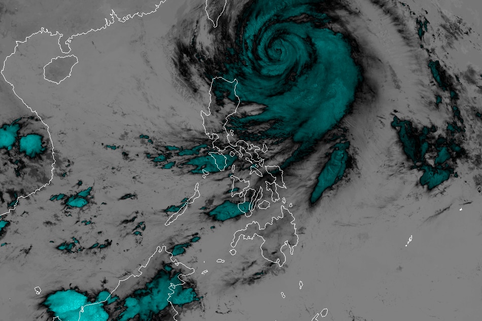
Imagery courtesy of the Japanese Meteorological Agency
MANILA (UPDATED) — Typhoon Betty has weakened over the sea of Batanes even as tropical cyclone wind signal no. 2 is still raised in some areas, state weather bureau PAGASA said Tuesday.
In its 11 a.m. bulletin, PAGASA said Betty is 315 kilometers east of Basco, Batanes, packing maximum sustained winds of 150 kilometers per hour near the center and gusts of up to 185 kph. It is moving west-northwestward over the sea of Batanes at 10 kph.
Tropical cyclone wind signal no. 2 is still raised over the following areas.
Batanes
the northeastern portion of Cagayan (Santa Ana, Gonzaga) including Babuyan Islands
Tropical cyclone wind signal no. 1, meanwhile, is hoisted over:
ADVERTISEMENT
the rest of mainland Cagayan
the northern and eastern portions of Isabela (Santo Tomas, Santa Maria, Quezon, San Mariano, Dinapigue, Delfin Albano, San Pablo, Ilagan City, Benito Soliven, Tumauini, Cabagan, Palanan, Quirino, Divilacan, Gamu, Maconacon, Naguilian, Mallig)
the eastern portion of Ilocos Norte (Piddig, Bangui, Vintar, Marcos, Pagudpud, Banna, Adams, Carasi, Dingras, Solsona, Dumalneg, Nueva Era) Apayao
the northern portion of Kalinga (City of Tabuk, Balbalan, Pinukpuk, Rizal)
the northeastern portion of Abra (Tineg, Lacub, Malibcong)
PAGASA said from Tuesday until Wednesday morning, 50 to 100 millimeters of rain was expected over Batanes, the eastern portion of Babuyan Islands, the northeastern portion of mainland Cagayan, Ilocos Norte, Ilocos Sur, and the northern portion of La Union.
ABS-CBN is the leading media and entertainment company in the Philippines, offering quality content across TV, radio, digital, and film. Committed to public service and promoting Filipino values, ABS-CBN continues to inspire and connect audiences worldwide.
Our website is made possible by displaying online
advertisements to our visitors. Please consider supporting
us by disabling your ad blocker on our website.
Our website is made possible by displaying online
advertisements to our visitors. Please consider supporting
us by disabling your ad blocker on our website.