Tropical depression Dante maintains strength, to bring rains over parts of Mindanao


ADVERTISEMENT

Welcome, Kapamilya! We use cookies to improve your browsing experience. Continuing to use this site means you agree to our use of cookies. Tell me more!
Tropical depression Dante maintains strength, to bring rains over parts of Mindanao
ABS-CBN News
Published May 30, 2021 11:55 PM PHT
|
Updated May 31, 2021 08:20 AM PHT
MANILA - Tropical depression Dante maintained its strength and is expected to bring rains over parts of Mindanao, state weather bureau PAGASA said Sunday night.
MANILA - Tropical depression Dante maintained its strength and is expected to bring rains over parts of Mindanao, state weather bureau PAGASA said Sunday night.
The center of Dante, the country's fourth storm this year, was estimated to be 685 kilometers east of Davao City, packing maximum sustained winds of 55 kilometers per hour (kph) near the center, with gusts of up to 70 kph.
The center of Dante, the country's fourth storm this year, was estimated to be 685 kilometers east of Davao City, packing maximum sustained winds of 55 kilometers per hour (kph) near the center, with gusts of up to 70 kph.
It is moving northwestward at 15 kph.
It is moving northwestward at 15 kph.
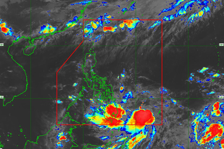
PAGASA warned that from Sunday until Monday evening, light to moderate with at times heavy rains will be experienced over the Caraga and Davao regions, Soccsksargen, Bukidnon and Misamis Oriental due to the outer rainbands of Dante.
PAGASA warned that from Sunday until Monday evening, light to moderate with at times heavy rains will be experienced over the Caraga and Davao regions, Soccsksargen, Bukidnon and Misamis Oriental due to the outer rainbands of Dante.
ADVERTISEMENT
“Under these conditions, isolated to scattered flooding (including flash floods) and rain-induced landslides are possible, especially in areas that are highly or very highly susceptible to these hazards as identified in hazard maps,” the weather bureau warned.
“Under these conditions, isolated to scattered flooding (including flash floods) and rain-induced landslides are possible, especially in areas that are highly or very highly susceptible to these hazards as identified in hazard maps,” the weather bureau warned.
Storm signals are not likely to be raised given the present track forecast for Dante, the agency said.
Storm signals are not likely to be raised given the present track forecast for Dante, the agency said.
“However, given the uncertainty in its track forecast, any further westward shift in the track forecast may lead to the hoisting of TCWS (Tropical Cyclone Wind Signal) over the eastern portion of the country,” it added.
“However, given the uncertainty in its track forecast, any further westward shift in the track forecast may lead to the hoisting of TCWS (Tropical Cyclone Wind Signal) over the eastern portion of the country,” it added.
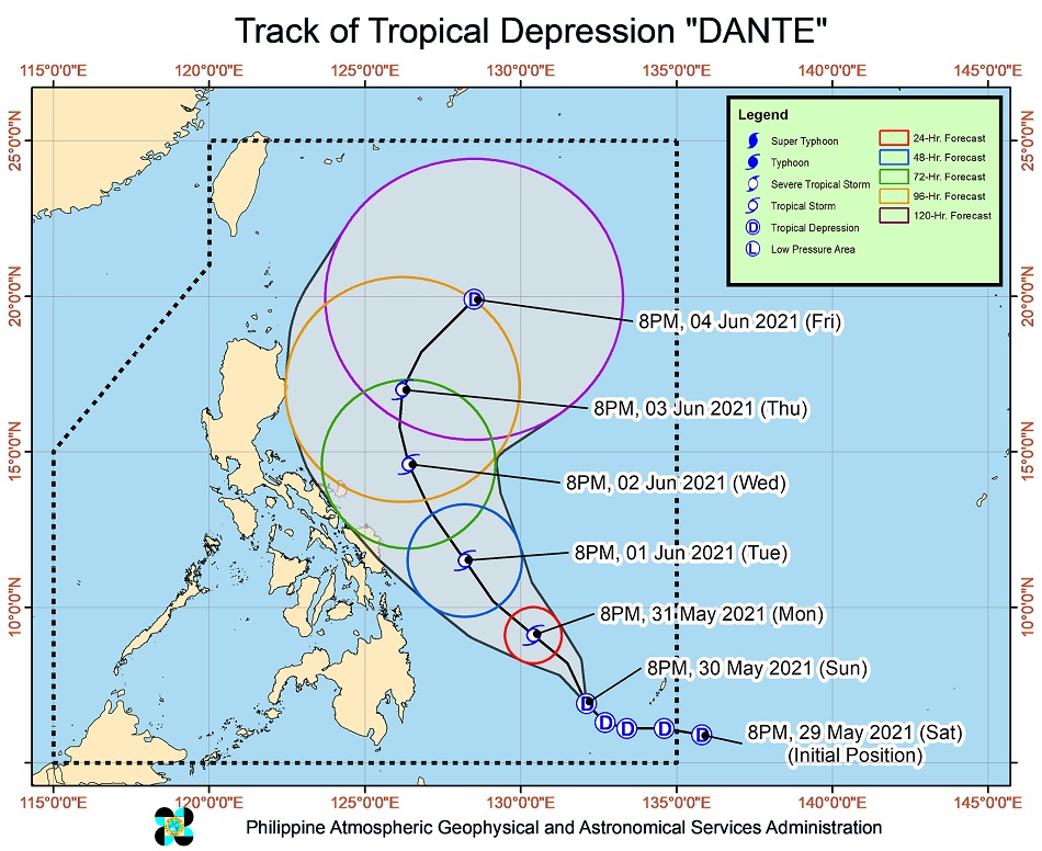
PAGASA said there is also an increasing likelihood that Dante will further intensify into a tropical storm by Monday. It is also expected to remain over the Philippine Sea throughout the forecast period, moving generally in the same northwestward direction until Wednesday.
PAGASA said there is also an increasing likelihood that Dante will further intensify into a tropical storm by Monday. It is also expected to remain over the Philippine Sea throughout the forecast period, moving generally in the same northwestward direction until Wednesday.
It will then turn north northwest by Thursday and northeastward by Friday.
It will then turn north northwest by Thursday and northeastward by Friday.
RELATED VIDEO
ADVERTISEMENT
ADVERTISEMENT