Shear line to dampen central PH, Amihan to bring nippy weather in Northern Luzon | ABS-CBN


ADVERTISEMENT

Welcome, Kapamilya! We use cookies to improve your browsing experience. Continuing to use this site means you agree to our use of cookies. Tell me more!
Shear line to dampen central PH, Amihan to bring nippy weather in Northern Luzon
Shear line to dampen central PH, Amihan to bring nippy weather in Northern Luzon
Ariel Rojas,
ABS-CBN News
Published Nov 20, 2023 07:37 AM PHT

Watch more on iWantTFC.com. Watch hundreds of Pinoy shows, movies, live sports and news.
Watch more on iWantTFC.com. Watch hundreds of Pinoy shows, movies, live sports and news.
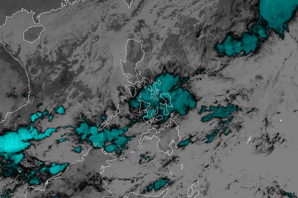
The shear line - where the cool Amihan and warm Pacific winds meet - will continue to affect the central part of the country Monday, the state weather bureau said.
The shear line - where the cool Amihan and warm Pacific winds meet - will continue to affect the central part of the country Monday, the state weather bureau said.
It will bring scattered rains in Bicol Region, MIMAROPA, Visayas, Northern Mindanao, and Caraga. Flooding and landslides remain a threat in these areas especially those which have been soaked for the past several days.
It will bring scattered rains in Bicol Region, MIMAROPA, Visayas, Northern Mindanao, and Caraga. Flooding and landslides remain a threat in these areas especially those which have been soaked for the past several days.
The northeast monsoon or Amihan will also continue to bring nippy conditions, especially in Northern Luzon. The temperature in Baguio City Sunday early morning dipped to 14.0°C -- the city's lowest this Amihan season so far.
The northeast monsoon or Amihan will also continue to bring nippy conditions, especially in Northern Luzon. The temperature in Baguio City Sunday early morning dipped to 14.0°C -- the city's lowest this Amihan season so far.
Amihan will bring light rains in Cagayan Valley, Apayao, and Quezon.
Amihan will bring light rains in Cagayan Valley, Apayao, and Quezon.
ADVERTISEMENT
Metro Manila and the rest of Luzon will experience generally fair weather with cool mornings and evenings. Isolated light rains are also possible but thunderstorms are unlikely.
Metro Manila and the rest of Luzon will experience generally fair weather with cool mornings and evenings. Isolated light rains are also possible but thunderstorms are unlikely.
Gale warning is also in effect over the seaboards of Ilocos provinces, Cagayan Valley, Aurora, northern Quezon, northern and eastern Bicol, Northern and Eastern Samar, and Kalayaan Islands due to big waves generated by the Amihan.
Gale warning is also in effect over the seaboards of Ilocos provinces, Cagayan Valley, Aurora, northern Quezon, northern and eastern Bicol, Northern and Eastern Samar, and Kalayaan Islands due to big waves generated by the Amihan.
Hot weather will prevail over the rest of Mindanao with possible isolated afternoon or evening thunderstorms that could last up to an hour or two.
Hot weather will prevail over the rest of Mindanao with possible isolated afternoon or evening thunderstorms that could last up to an hour or two.
Meanwhile, the low pressure area off Surigao del Norte dissipated Sunday afternoon.
Meanwhile, the low pressure area off Surigao del Norte dissipated Sunday afternoon.
PAGASA weather forecaster Robert Badrina says that they are not monitoring new weather disturbance and that it is less likely for a storm to form this week.
PAGASA weather forecaster Robert Badrina says that they are not monitoring new weather disturbance and that it is less likely for a storm to form this week.
ADVERTISEMENT
ADVERTISEMENT