Welcome, Kapamilya! We use cookies to improve your browsing experience. Continuing to use this site means you agree to our use of cookies. Tell me more!
Watch more on iWantTFC.com. Watch hundreds of Pinoy shows, movies, live sports and news.
Watch more on iWantTFC.com. Watch hundreds of Pinoy shows, movies, live sports and news.
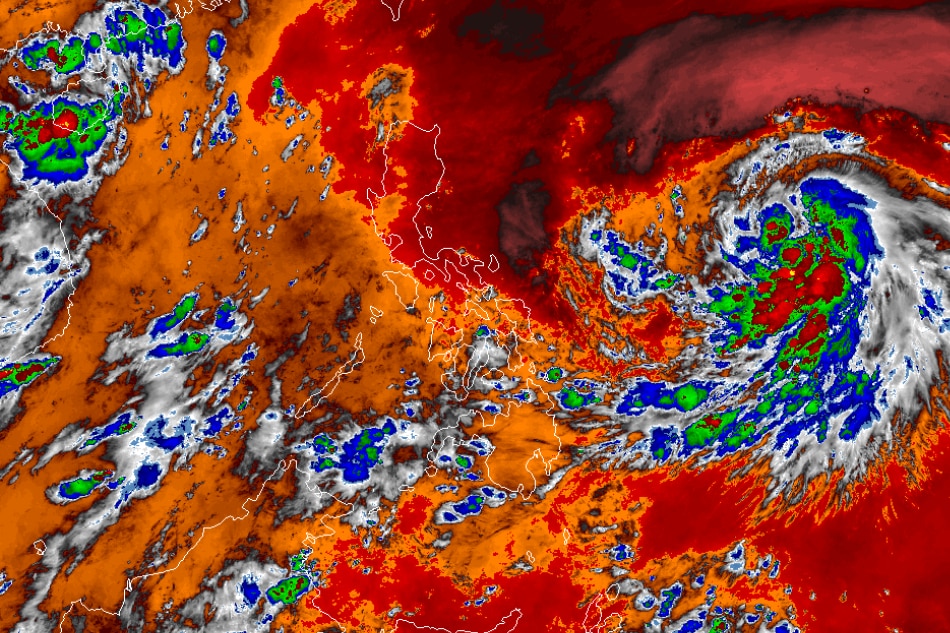
MANILA (UPDATED) — Chedeng has intensified into a tropical storm as it hovers over the Philippine Sea, state weather bureau PAGASA said Wednesday.
In its 11 a.m. bulletin, PAGASA said Chedeng was 1,190 kilometers east of southeastern Luzon.
Chedeng is packing maximum sustained winds of 75 kilometers per hour near the center and gusts of up to 90 kph. It is moving west-northwestward at 10 kph.
Chedeng is unlikely to directly bring heavy rainfall over any portion of the country in the next 3 to 5 days, and is not expected to affect Philippine weather.
ADVERTISEMENT
It is forecast to move generally northwestward or west-northwestward from Wednesday through mid-Friday, before turning more northward or north-northeastward for the rest of Friday through the weekend, according to the weather agency.
"Throughout the forecast period, Chedeng will remain far from the Philippine landmass," PAGASA said.
Meanwhile, the southwest monsoon or habagat is affecting the western section of southern Luzon.
Palawan will have cloudy skies with rain showers and thunderstorms due to the habagat, while Metro Manila and the rest of the country will have partly cloudy to cloudy skies with isolated rain showers or thunderstorms.
Imagery courtesy of the Japanese Meteorological Agency
ABS-CBN is the leading media and entertainment company in the Philippines, offering quality content across TV, radio, digital, and film. Committed to public service and promoting Filipino values, ABS-CBN continues to inspire and connect audiences worldwide.
Our website is made possible by displaying online
advertisements to our visitors. Please consider supporting
us by disabling your ad blocker on our website.
Our website is made possible by displaying online
advertisements to our visitors. Please consider supporting
us by disabling your ad blocker on our website.