'Vicky' intensifies outside PAR; Signal no. 2 up in Kalayaan Islands | ABS-CBN

Welcome, Kapamilya! We use cookies to improve your browsing experience. Continuing to use this site means you agree to our use of cookies. Tell me more!
'Vicky' intensifies outside PAR; Signal no. 2 up in Kalayaan Islands
'Vicky' intensifies outside PAR; Signal no. 2 up in Kalayaan Islands
ABS-CBN News
Published Dec 21, 2020 01:08 AM PHT
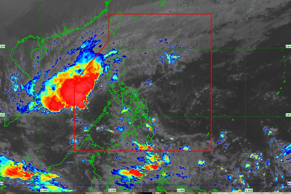
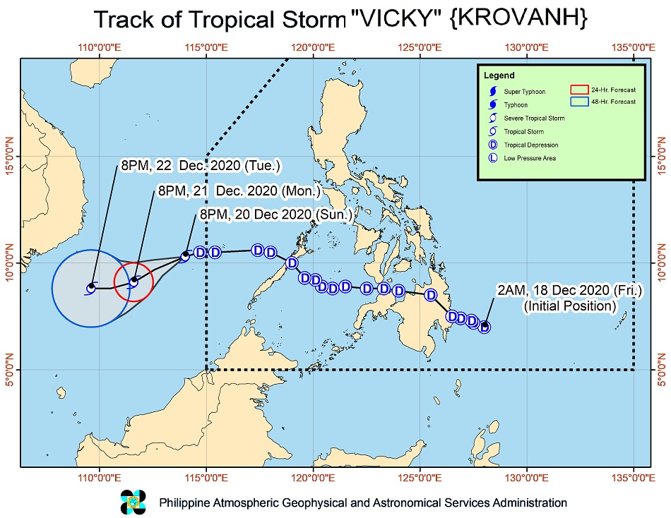
MANILA - Weather disturbance "Vicky" (international name: Krovanh), which is now a tropical storm, is still affecting parts of the country even after it exited the Philippine area of responsibility, the state weather bureau said Sunday.
MANILA - Weather disturbance "Vicky" (international name: Krovanh), which is now a tropical storm, is still affecting parts of the country even after it exited the Philippine area of responsibility, the state weather bureau said Sunday.
In its 11 p.m. weather bulletin Sunday, PAGASA said strong winds brought by the storm and the surge of the northeast monsoon will bring gale-force winds in Kalayaan Islands, Batanes, Babuyan Islands, and the northern portions of Cagayan, Apayao, and Ilocos Norte.
In its 11 p.m. weather bulletin Sunday, PAGASA said strong winds brought by the storm and the surge of the northeast monsoon will bring gale-force winds in Kalayaan Islands, Batanes, Babuyan Islands, and the northern portions of Cagayan, Apayao, and Ilocos Norte.
Vicky was last spotted 85 kilometers south southwest of Kalayaan, Palawan as of 10 p.m., packing maximum sustained winds of 65 kilometers per hour near the center, and gusts of up to 80 kph.
Vicky was last spotted 85 kilometers south southwest of Kalayaan, Palawan as of 10 p.m., packing maximum sustained winds of 65 kilometers per hour near the center, and gusts of up to 80 kph.
Storm signal no. 2 is now hoisted over Kalayaan Islands, where 61 to 120 kph winds could totally unroof nipa and cogon huts, damage rice and corn crops and down banana plants and mango trees.
Storm signal no. 2 is now hoisted over Kalayaan Islands, where 61 to 120 kph winds could totally unroof nipa and cogon huts, damage rice and corn crops and down banana plants and mango trees.
ADVERTISEMENT
PAGASA said Kalayaan Island, the eastern portion of mainland Cagayan Valley, Aurora and the northern portion of Quezon will experience moderate to heavy rains until Monday, while light to moderate with at times heavy rains may persist over the rest of mainland Cagayan Valley, Babuyan Islands, Apayao, Kalinga, Mountain Province, Ifugao, and the rest of Quezon.
PAGASA said Kalayaan Island, the eastern portion of mainland Cagayan Valley, Aurora and the northern portion of Quezon will experience moderate to heavy rains until Monday, while light to moderate with at times heavy rains may persist over the rest of mainland Cagayan Valley, Babuyan Islands, Apayao, Kalinga, Mountain Province, Ifugao, and the rest of Quezon.
Flooding and rain-induced landslides may occur during heavy or prolonged periods of rainfall, especially in areas highly susceptible to these hazards and those that received heavy rainfall recently, it added.
Flooding and rain-induced landslides may occur during heavy or prolonged periods of rainfall, especially in areas highly susceptible to these hazards and those that received heavy rainfall recently, it added.
At least 1 more storm is forecast to enter the country before the year ends, PAGASA weather forecaster Chris Perez earlier said.
At least 1 more storm is forecast to enter the country before the year ends, PAGASA weather forecaster Chris Perez earlier said.
ADVERTISEMENT
ADVERTISEMENT


