Signal no. 3 may be raised amid threat of tropical storm: PAGASA | ABS-CBN


Welcome, Kapamilya! We use cookies to improve your browsing experience. Continuing to use this site means you agree to our use of cookies. Tell me more!
Signal no. 3 may be raised amid threat of tropical storm: PAGASA
Signal no. 3 may be raised amid threat of tropical storm: PAGASA
ABS-CBN News
Published Dec 14, 2021 12:05 PM PHT
|
Updated Dec 14, 2021 01:41 PM PHT
MANILA - Tropical cyclone warning signal no. 3 may be raised over parts of the country when a severe tropical storm enters the Philippine Area of Responsibility (PAR), according to PAGASA.
MANILA - Tropical cyclone warning signal no. 3 may be raised over parts of the country when a severe tropical storm enters the Philippine Area of Responsibility (PAR), according to PAGASA.
"There is a high likelihood that Tropical Cyclone Wind Signals will be hoisted for Visayas, large portions of Mindanao, and several provinces in Southern Luzon due to the threat of strong to typhoon-force winds associated with the passage of 'Rai,' the state weather bureau said in its 11:00 am tropical cyclone advisory on Tuesday.
"There is a high likelihood that Tropical Cyclone Wind Signals will be hoisted for Visayas, large portions of Mindanao, and several provinces in Southern Luzon due to the threat of strong to typhoon-force winds associated with the passage of 'Rai,' the state weather bureau said in its 11:00 am tropical cyclone advisory on Tuesday.
"The highest possible wind signal that may be hoisted is TCWS #3," the advisory added.
"The highest possible wind signal that may be hoisted is TCWS #3," the advisory added.
"Localities situated in the eastern portions of Visayas and Mindanao may be placed under TCWS #1 as early as this afternoon or evening," it also read.
"Localities situated in the eastern portions of Visayas and Mindanao may be placed under TCWS #1 as early as this afternoon or evening," it also read.
ADVERTISEMENT
Rai, which will be identified as Odette once it enters PAR, has intensified into a severe tropical storm.
Rai, which will be identified as Odette once it enters PAR, has intensified into a severe tropical storm.
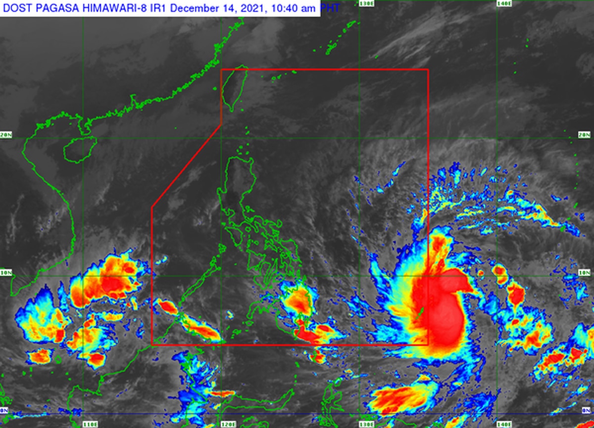
PAGASA said it was last seen 1,165 km east of Mindanao as of 10 a.m. Tuesday. It has maximum sustained winds of 95 kph near the center and gustiness of up to 115 kph.
PAGASA said it was last seen 1,165 km east of Mindanao as of 10 a.m. Tuesday. It has maximum sustained winds of 95 kph near the center and gustiness of up to 115 kph.
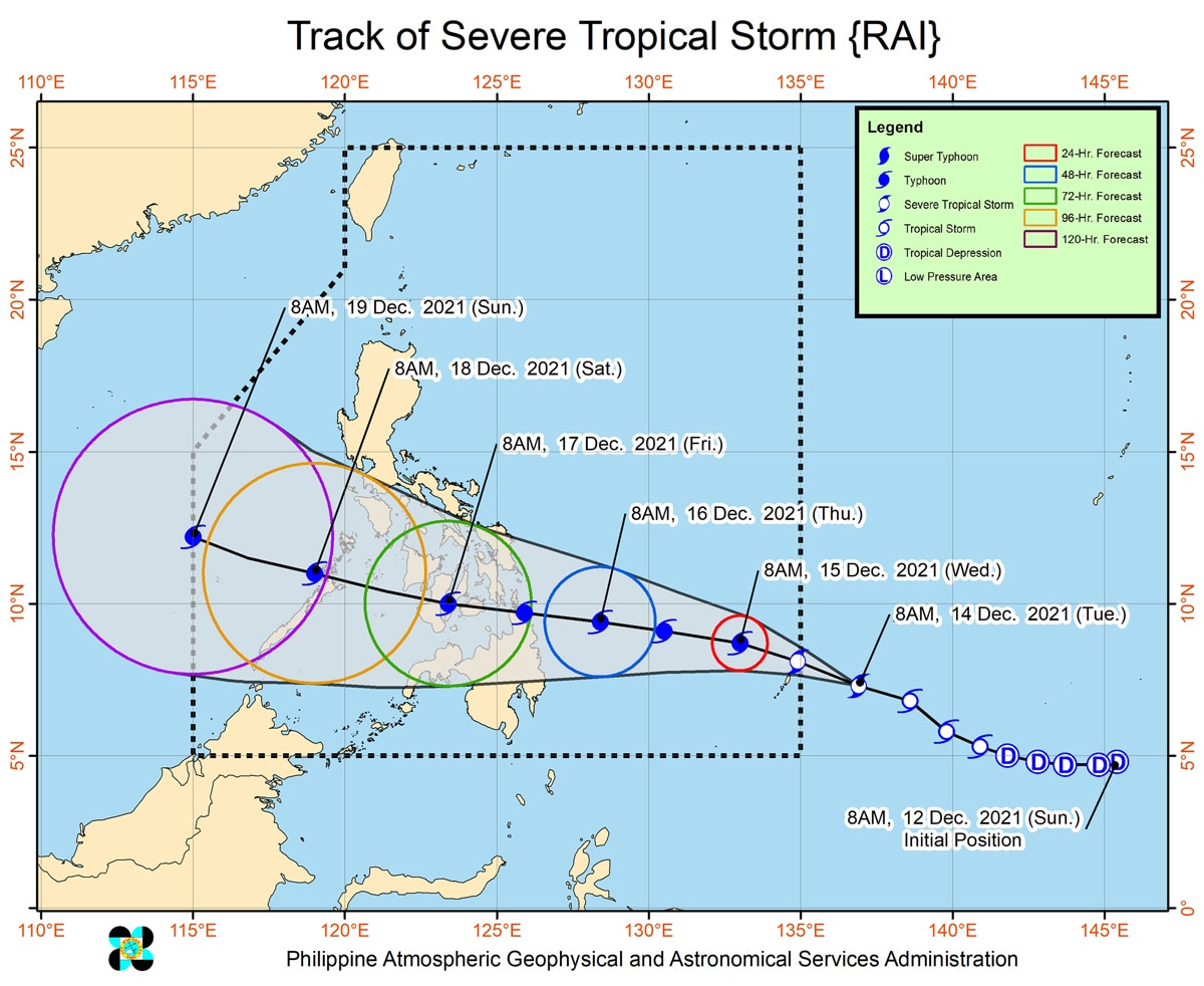
The storm is moving west northwestward at 30 kph.
The storm is moving west northwestward at 30 kph.
The state weather bureau said it will begin moving westward over the Philippine Sea on Wednesday afternoon, and may make landfall in the vicinity of Caraga or Eastern Visayas by Thursday (December 16) afternoon or evening.
The state weather bureau said it will begin moving westward over the Philippine Sea on Wednesday afternoon, and may make landfall in the vicinity of Caraga or Eastern Visayas by Thursday (December 16) afternoon or evening.
The storm is forecast to reach typhoon category on Wednesday. A pre-landfall peak intensity of around 155 kph may be reached by Thursday morning or afternoon.
The storm is forecast to reach typhoon category on Wednesday. A pre-landfall peak intensity of around 155 kph may be reached by Thursday morning or afternoon.
In the next 24 hours, the trough or extension of Rai will bring light to moderate with at times heavy rains over Caraga and Davao Oriental, PAGASA said in its 11 a.m. advisory.
In the next 24 hours, the trough or extension of Rai will bring light to moderate with at times heavy rains over Caraga and Davao Oriental, PAGASA said in its 11 a.m. advisory.
The story may lash some 10,000 barangays in Visayas and Mindanao, and parts of southern Luzon, said National Disaster Risk Reduction and Management Council (NDRRMC) spokesperson Mark Timbal.
The story may lash some 10,000 barangays in Visayas and Mindanao, and parts of southern Luzon, said National Disaster Risk Reduction and Management Council (NDRRMC) spokesperson Mark Timbal.
Local governments in areas at risk were reminded to conduct preemptive evacuations, he said in a televised public briefing.
Local governments in areas at risk were reminded to conduct preemptive evacuations, he said in a televised public briefing.
Timbal added that inter-island sea travel would be suspended in Bicol, Eastern Visayas, and Caraga regions as a precaution.
Timbal added that inter-island sea travel would be suspended in Bicol, Eastern Visayas, and Caraga regions as a precaution.
“We are monitoring this tropical depression very closely. We’re putting everybody on alert,” Cabinet Secretary Carlo Nograles said in a separate press briefing.
“We are monitoring this tropical depression very closely. We’re putting everybody on alert,” Cabinet Secretary Carlo Nograles said in a separate press briefing.
Government has around P951 million in standby funds and stockpile relief goods, said Nograles, acting spokesman for Malacañang.
Government has around P951 million in standby funds and stockpile relief goods, said Nograles, acting spokesman for Malacañang.
He said President Rodrigo Duterte would meet with officials if necessary.
He said President Rodrigo Duterte would meet with officials if necessary.
“Si Pangulong Duterte naman ay mabilis umaksyon ‘pag kinakailangan,” he said in a press briefing.
“Si Pangulong Duterte naman ay mabilis umaksyon ‘pag kinakailangan,” he said in a press briefing.
(President Duterte acts swiftly, if needed.)
- reports from Benise Balaoing and Jamaine Punzalan, ABS-CBN News
(President Duterte acts swiftly, if needed.)
- reports from Benise Balaoing and Jamaine Punzalan, ABS-CBN News
Read More:
Philippines weather
PAGASA
tropical depression Odette
OdettePH
Philippines weather December 14 2021
bagyo 2021
weather today
Philippines weather news today
ADVERTISEMENT
ADVERTISEMENT