Welcome, Kapamilya! We use cookies to improve your browsing experience. Continuing to use this site means you agree to our use of cookies. Tell me more!
‘Siony’ maintains strength as it leaves PAR; weather disturbance to enter PH
‘Siony’ maintains strength as it leaves PAR; weather disturbance to enter PH
ABS-CBN News
Published Nov 06, 2020 01:13 PM PHT
PAGASA
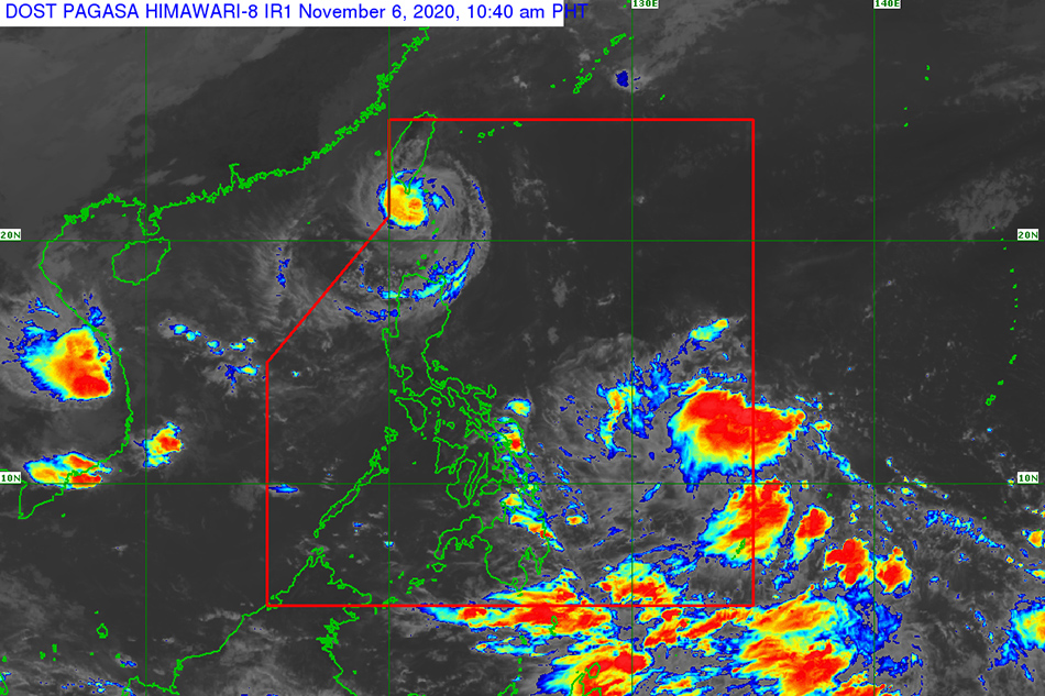
MANILA — Severe tropical storm Siony maintained its strength Friday morning while it moved over Bashi channel even as another weather disturbance is set to enter the Philippine area of responsibility, the state weather bureau said.
In its 11 a.m. bulletin, PAGASA forecast the storm to leave PAR Friday night.
While it is forecast to maintain its strength in the next 12 hours, the state weather bureau said it will “significantly weaken” because of unfavorable conditions related to the northeasterlies over the West Philippine Sea.
Meanwhile, a Low Pressure Area (LPA) was spotted outside PAR and was estimated 1,195 kilometers east of Mindanao. It is forecast to move generally west northwest and is forecast to enter PAR Friday afternoon or evening.
ADVERTISEMENT
The LPA may develop into tropical depression within the next 2 days and it will be called “Tonyo,” according to PAGASA.
“It is heading towards the direction of Eastern Visayas and may likely reach the area tomorrow afternoon or evening,” it said.
Siony, which packs maximum sustained winds of 95 kph near the center and gusts of up to 115 kph, was spotted 50 km northwest of Itbayat, Batanes and is moving westward at 20 kilometers per hour.
Batanes was still placed under tropical cyclone wind signal (TCWS) no. 2, where 61-120 kph winds were expected within 24 hours and may damage wooden and old electric posts.
TCWS no. 1, meanwhile, was hoisted over Babuyan Islands, where 30-60 kph winds may rip roofs off nipa and cogon huts, damage rice crops and down banana plants.
Batanes and Babuyan Islands will experience moderate to heavy rains Friday due to the storm. PAGASA warned that flooding, flash floods, and rain-induced landslides may occur during heavy or prolonged rainfall especially in areas identified in geohazard maps as highly or very highly susceptible to these hazards.
The storm will continue moving over the sea off Taiwan’s southern coast in the next 12 hours and may be downgraded to a low pressure area on Sunday afternoon, PAGASA said.
ABS-CBN is the leading media and entertainment company in the Philippines, offering quality content across TV, radio, digital, and film. Committed to public service and promoting Filipino values, ABS-CBN continues to inspire and connect audiences worldwide.