Welcome, Kapamilya! We use cookies to improve your browsing experience. Continuing to use this site means you agree to our use of cookies. Tell me more!
LOOK: Typhoon Rolly and Metro Manila seen from space
LOOK: Typhoon Rolly and Metro Manila seen from space
ABS-CBN News
Published Oct 30, 2020 10:07 PM PHT
|
Updated Oct 31, 2020 02:16 AM PHT
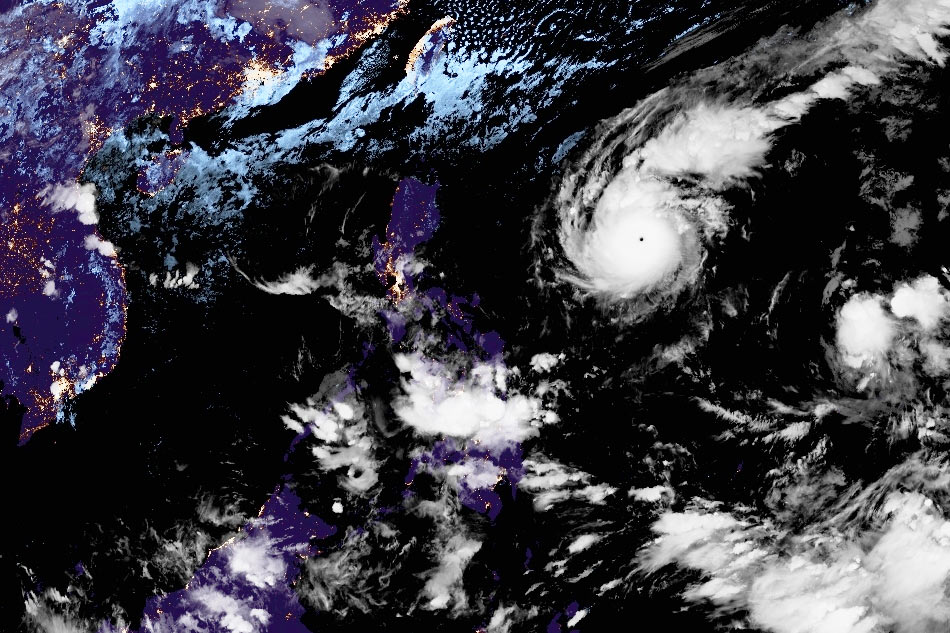
Himawari-8/US NOAA image
MANILA - Japan's Himawari-8 geostationary weather satellite has captured images of Metro Manila and Typhoon Rolly, which is expected to slam into Luzon this weekend.
Metro Manila is seen brightly lit and the Philippines is partly covered by clouds in the center of one photo, while the tropical cyclone, with its pinhole eye, is seen in a spiral shape on the right.
Rolly (international name Goni), reached super typhoon status Friday, according to the United States Navy – United States Air Force Joint Typhoon Warning Center's (JTWC) category of tropical cyclones in the Pacific.
The Japan Meteorological Agency on Friday classified Rolly as a "violent typhoon", the highest in its classification of tropical cyclones.
ADVERTISEMENT
Rolly, which is currently packing maximum sustained winds of 150 knots (277.8 kilometers per hour) and gusts reaching 180 knots (333.36 kph) based on the JTWC's one-minute average readings, is the strongest typhoon in the world so far this year.
To compare, super typhoon Yolanda recorded 315 kph maximum sustained winds on 1-minute average readings just before landfall in 2013.
Typhoon Rolly is expected to weaken as it approaches the Philippine landmass and undergo an eyewall replacement cycle, according to JTWC.
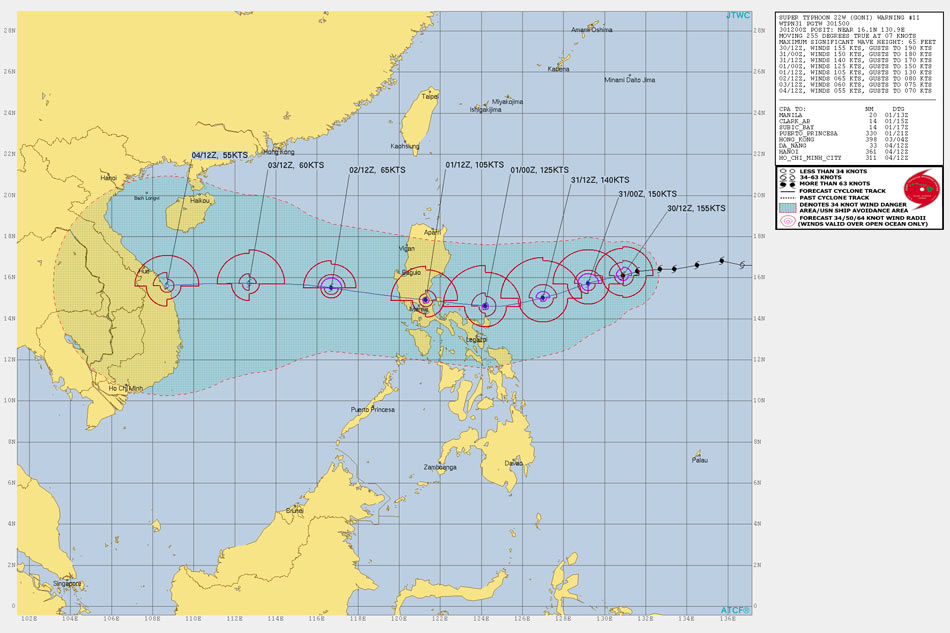
US JTWC forecast track of Typhoon Rolly
The tropical cyclone has likely peaked in intensity as it churns toward the Philippines, but "there is the possibility of a slightly higher peak" intensity in the next 12 hours, the US military weather bureau said.
"After landfall, the system will transit across the mountainous terrain of Central Luzon, reemerging into the South China Sea as a minimal typhoon of 65 knots after weakening significantly under the combined influence of terrain interaction, increased vws (vertical wind shear) and entrainment of cooler and drier air from the northeast," JTWC added.
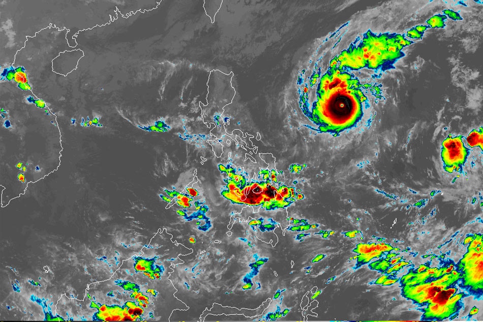
Himawari-8/US NOAA image
Philippine state weather bureau PAGASA on Friday said the eye of Typhoon Rolly is likely to make landfall over the Aurora-Quezon area on Sunday evening or Monday early morning at an intensity of 175 kph to 195 kph, based on 10-minute average readings of maximum sustained winds.
Aside from destructive winds and torrential rains, the typhoon may trigger a storm surge of up to two meters in the coastal areas of Aurora, Quezon, Marinduque, Bicol Region, and Northern Samar, PAGASA warned.
ABS-CBN is the leading media and entertainment company in the Philippines, offering quality content across TV, radio, digital, and film. Committed to public service and promoting Filipino values, ABS-CBN continues to inspire and connect audiences worldwide.
Our website is made possible by displaying online
advertisements to our visitors. Please consider supporting
us by disabling your ad blocker on our website.
Our website is made possible by displaying online
advertisements to our visitors. Please consider supporting
us by disabling your ad blocker on our website.