Welcome, Kapamilya! We use cookies to improve your browsing experience. Continuing to use this site means you agree to our use of cookies. Tell me more!
What NASA satellites found around Typhoon Ompong's eye
What NASA satellites found around Typhoon Ompong's eye
ABS-CBN News
Published Sep 14, 2018 05:11 AM PHT
The MODIS instrument aboard NASA’s Aqua satellite looked at Typhoon Ompong in infrared light as it was approaching the Philippines. NASA/NRL imagery
Storms within a superstorm.
U.S. National Aeronautics and Space Administration (NASA) satellites tracking Typhoon Ompong (international name Super Typhoon Mangkhut) have found powerful storms surrounding the eye of the tropical cyclone days before its landfall over northern Luzon.
On September 13, the MODIS instrument on the Aqua satellite looked at Ompong in infrared as it was approaching the Philippines, NASA Goddard Space Flight Center's Rob Gutro said in a blog post.
The satellite's instrument "found coldest cloud top temperatures around the eye, as cold as or colder than minus 80 degrees Fahrenheit (F)/minus 112 degrees Celsius (C). Surrounding the eye were thick rings of powerful storms with cloud tops as cold as or colder than minus 70F (minus 56.6C)," he added.
ADVERTISEMENT
He cited NASA research, which said that cloud top temperatures as cold as or colder than the 70F/56.6C threshold have the capability to generate heavy rainfall, which forewarn of torrential rains that Ompong may bring to Luzon.
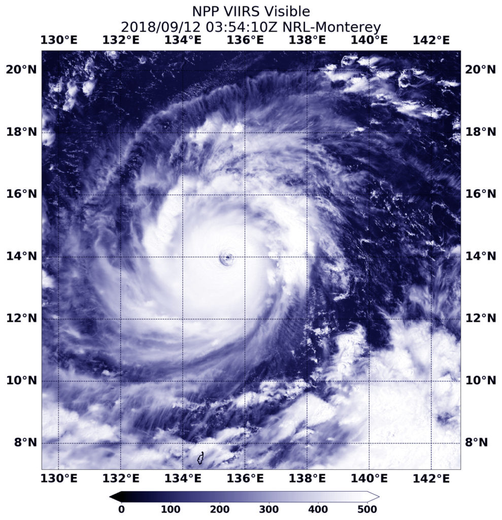
NASA-NOAA’s Suomi NPP satellite flew directly over Typhoon Ompong on September 11. NASA/NOAA/NRL imagery
Another satellite, the NASA-NOAA Suomi NPP, passed directly over Ompong from space two days earlier and stared down its eye.
"Visible imagery on Sept. 12 at 11:44 p.m. EDT (Sept. 12 at 0354 UTC from the Visible Infrared Imaging Radiometer Suite (VIIRS) instrument aboard NASA-NOAA’s Suomi NPP satellite showed that Mangkhut had a clear eye that enabled the satellite to see through it all the way to the surface of the Northwestern Pacific Ocean," Gutro said.
"Mangkhut was surrounded by a thick ring of powerful, rotating thunderstorms," he added.
Gutro mentioned a report by the U.S. Joint Typhoon Warning Center showing that strong, compact feeder bands of thunderstorms were spiraling tightly into the typhoon's eye.
ADVERTISEMENT
JTWC considers Ompong as a super typhoon and equal to a Category 5 hurricane in the western hemisphere.
In its latest analysis, the Hawaii-based joint U.S. Navy-Air Force command said the typhoon is currently packing 278kph sustained winds and gusts reaching 333 kph in 1-minute readings.
It warned that Ompong may continue to strengthen Friday, reaching peak intensity of 287 kph winds and 352 kph gusts before landfall.
The typhoon is expected to make landfall in Cagayan-Isabela area on Saturday, September 15, according to Philippine state weather bureau PAGASA.
ABS-CBN is the leading media and entertainment company in the Philippines, offering quality content across TV, radio, digital, and film. Committed to public service and promoting Filipino values, ABS-CBN continues to inspire and connect audiences worldwide.
Our website is made possible by displaying online
advertisements to our visitors. Please consider supporting
us by disabling your ad blocker on our website.
Our website is made possible by displaying online
advertisements to our visitors. Please consider supporting
us by disabling your ad blocker on our website.