Welcome, Kapamilya! We use cookies to improve your browsing experience. Continuing to use this site means you agree to our use of cookies. Tell me more!
Super typhoon, tropical depression may merge: PAGASA
Super typhoon, tropical depression may merge: PAGASA
ABS-CBN News
Published Aug 31, 2022 12:30 AM PHT
|
Updated Aug 31, 2022 07:43 AM PHT
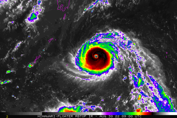
Super typhoon Hinnamnor. US NOAA/Himawari 8
MANILA—Super typhoon Hinnamnor and tropical depression Gardo may merge while inside the Philippine area of responsibility (PAR), state weather bureau PAGASA said Tuesday.
In its 11 p.m. weather bulletin, PAGASA said Gardo was last sighted approximately 1,125 km east of extreme northern Luzon packing maximum sustained winds of 55 kph near the center with 70 kph gusts while moving west southwestward at 10 kph.
The tropical depression is unlikely to directly affect the weather and sea conditions in the country until early Wednesday morning, the agency said.
But Gardo is projected to intensify into a tropical storm by Wednesday, PAGASA noted.
"However, the disturbance may degenerate into a remnant low by tomorrow afternoon or evening as 'HINNAMNOR' begins to assimilate its circulation," the weather agency said.
PAGASA earlier said Hinnamnor may enter the PAR Wednesday evening, and may still intensify. It reached the super typhoon category at 2 p.m. Tuesday. It is the first super typhoon that may enter the PAR this year.
In its 5 p.m. bulletin, the agency said Hinnamnor, which was last spotted 1,485 kilometers east-northeast of extreme northern Luzon, was packing 185 kph maximum sustained winds and up to 230 kph gusts.
ABS-CBN is the leading media and entertainment company in the Philippines, offering quality content across TV, radio, digital, and film. Committed to public service and promoting Filipino values, ABS-CBN continues to inspire and connect audiences worldwide.
Our website is made possible by displaying online
advertisements to our visitors. Please consider supporting
us by disabling your ad blocker on our website.
Our website is made possible by displaying online
advertisements to our visitors. Please consider supporting
us by disabling your ad blocker on our website.