Welcome, Kapamilya! We use cookies to improve your browsing experience. Continuing to use this site means you agree to our use of cookies. Tell me more!
Florita leaves Philippine area of responsibility, storm signals still up
Florita leaves Philippine area of responsibility, storm signals still up
ABS-CBN News
Published Aug 24, 2022 06:24 AM PHT
|
Updated Aug 24, 2022 12:57 PM PHT
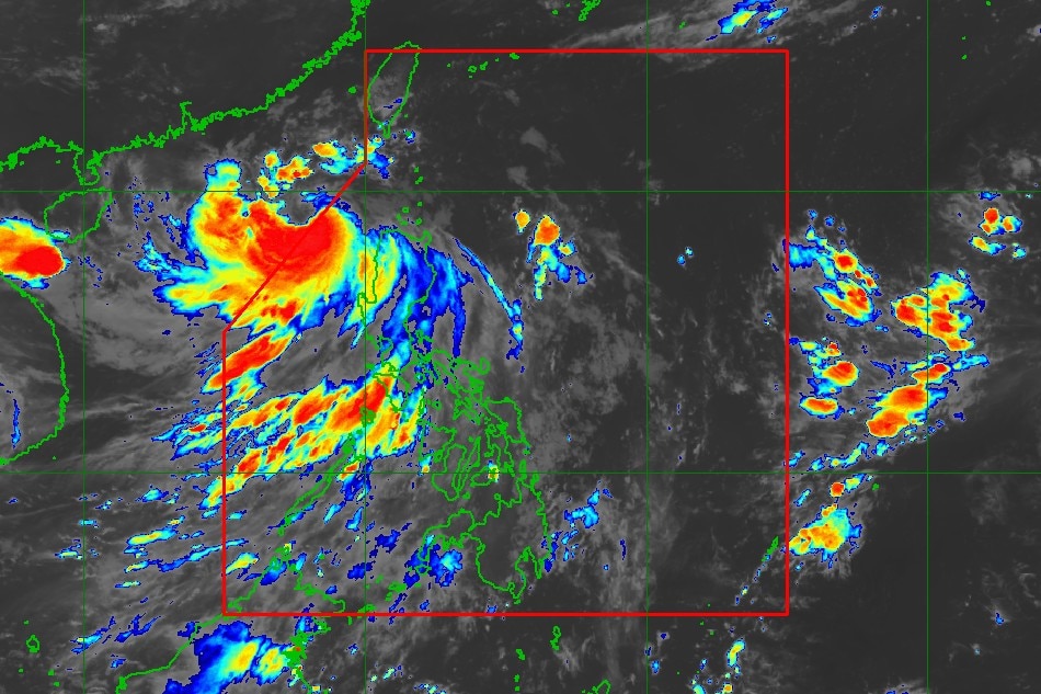
PAGASA image
MANILA—Severe tropical storm Florita has left the Philippine area of responsibility after inundating different parts of Luzon on Tuesday, the state weather bureau said.
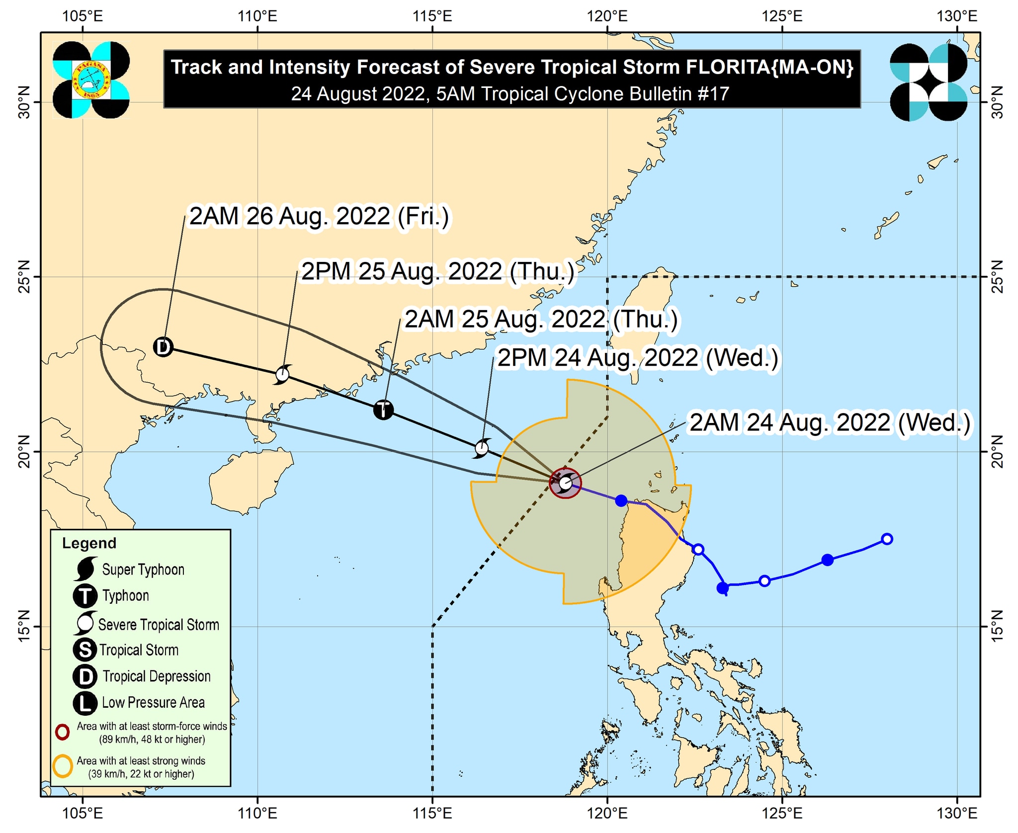
In its 5 a.m. weather bulletin, PAGASA said that Florita was sighted approximately 335 km west of Calayan, Cagayan at 4 a.m., packing maximum sustained winds of 95 kph near the center with 115 kph gusts, while moving west northwestward at 30 kph.
Tropical cyclone wind signal no. 1 is still in effect in:
Batanes
Babuyan Islands
Western portion of mainland Cagayan (Claveria, Santa Praxedes, Sanchez-Mira, Pamplona, Abulug, Ballesteros, Allacapan, Aparri, Lasam, Santo Niño, Rizal)
Apayao
Abra
Western portion of Kalinga (Balbalan, Pasil, Tinglayan)
Western portion of Mountain Province (Bauko, Tadian, Besao, Sagada, Sabangan, Bontoc, Sadanga)
Northern and western portions of Benguet (Mankayan, Bakun, Kibungan, Kapangan, Tublay, La Trinidad, Sablan, Tuba, Baguio City, Atok)
Ilocos Norte
Ilocos Sur
La Union
PAGASA image
On Wednesday, light to heavy rains will fall in Ilocos Region, Abra, and Benguet, while light to moderate with at times heavy rains will be experienced in the rest of Cordillera Administrative Region.
ADVERTISEMENT
"Rainfall caused by Florita is forecast to gradually weaken throughout the day. However, scattered flooding (including flash floods) and rain-induced landslides are still expected especially in areas that are highly or very highly susceptible to these hazard as identified in hazard maps, and in localities with significant antecedent rainfall," PAGASA said.
The weather agency noted that the southwest monsoon or "habagat" may still bring rains to the western sections of central and southern Luzon.
"Strong winds (strong breeze to near gale strength) will be experienced within any of the areas where Wind Signal no. 1 is currently in effect," it said.
The weather bureau said gusts reaching strong breeze to gale-force strength may still be experienced (especially in the coastal and mountainous areas) over MIMAROPA, Metro Manila, Cavite, Quezon, Bulacan, Pampanga, Pangasinan, Aurora, and localities of Cordillera Administrative Region and Cagayan Valley that are not under any wind signal.
PAGASA projected Florita will make landfall in southern China on Thursday.
ABS-CBN is the leading media and entertainment company in the Philippines, offering quality content across TV, radio, digital, and film. Committed to public service and promoting Filipino values, ABS-CBN continues to inspire and connect audiences worldwide.
Our website is made possible by displaying online
advertisements to our visitors. Please consider supporting
us by disabling your ad blocker on our website.
Our website is made possible by displaying online
advertisements to our visitors. Please consider supporting
us by disabling your ad blocker on our website.