'Gardo' speeds up, to exit PAR Tuesday night | ABS-CBN


Welcome, Kapamilya! We use cookies to improve your browsing experience. Continuing to use this site means you agree to our use of cookies. Tell me more!
'Gardo' speeds up, to exit PAR Tuesday night
'Gardo' speeds up, to exit PAR Tuesday night
ABS-CBN News
Published Jul 10, 2018 12:56 AM PHT
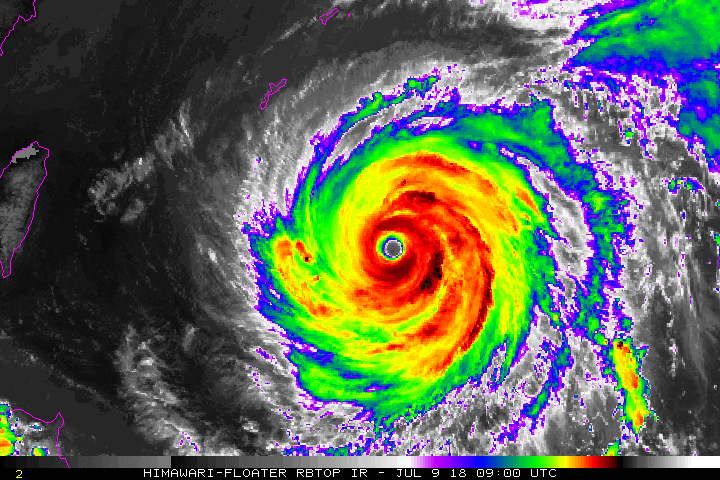
MANILA - Typhoon Gardo has picked up speed as it moves towards waters north of the Philippines, state weather bureau PAGASA said Monday night.
MANILA - Typhoon Gardo has picked up speed as it moves towards waters north of the Philippines, state weather bureau PAGASA said Monday night.
In its 11 p.m. advisory Monday, weather specialist Ariel Rojas said Gardo is expected to leave the Philippine Area of Responsibility (PAR) as early as Tuesday night.
In its 11 p.m. advisory Monday, weather specialist Ariel Rojas said Gardo is expected to leave the Philippine Area of Responsibility (PAR) as early as Tuesday night.
The typhoon, which has the international name Maria, was last spotted 860 kilometers east northeast of Basco, Batanes.
The typhoon, which has the international name Maria, was last spotted 860 kilometers east northeast of Basco, Batanes.
Gardo is packing maximum sustained winds of 185 kilometers per hour (kph) near the center, with gusts of up to 225 kph as of Monday night. It is forecast to move west-northwest at 30 kph.
Gardo is packing maximum sustained winds of 185 kilometers per hour (kph) near the center, with gusts of up to 225 kph as of Monday night. It is forecast to move west-northwest at 30 kph.
ADVERTISEMENT
Mimaropa and Western Visayas will experience occasional rains brought by the southwest monsoon or habagat.
Mimaropa and Western Visayas will experience occasional rains brought by the southwest monsoon or habagat.
Scattered rainshowers and thunderstorms wil prevail over Metro Manila, Calabarzon, Bicol Region, Zambales, Bataan, and Aurora.
Scattered rainshowers and thunderstorms wil prevail over Metro Manila, Calabarzon, Bicol Region, Zambales, Bataan, and Aurora.
Residents in these areas are advised to take precautionary measures against possible flooding and landslides.
Residents in these areas are advised to take precautionary measures against possible flooding and landslides.
PAGASA also warned of risky sea travel over the northern and eastern seaboards of northern Luzon.
PAGASA also warned of risky sea travel over the northern and eastern seaboards of northern Luzon.
Visit the ABS-CBN Weather Center for the latest weather updates.
ADVERTISEMENT
ADVERTISEMENT