Welcome, Kapamilya! We use cookies to improve your browsing experience. Continuing to use this site means you agree to our use of cookies. Tell me more!
Tropical depression Caloy lingers over West Philippine Sea, to stir rains: PAGASA
Tropical depression Caloy lingers over West Philippine Sea, to stir rains: PAGASA
ABS-CBN News
Published Jun 29, 2022 12:38 PM PHT
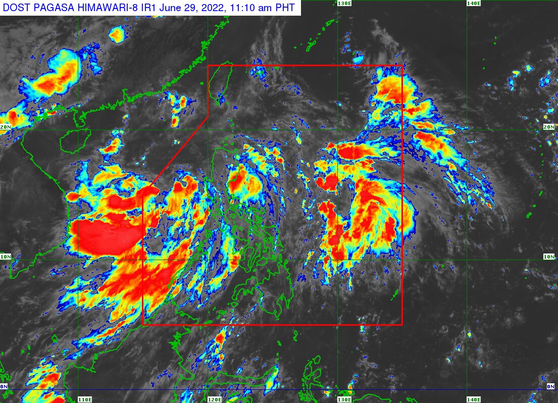
This satellite image from PAGASA shows the location of tropical depression Caloy around 11 a.m., Wednesday.
MANILA — Tropical depression Caloy lingered over the West Philippine Sea on Wednesday and would continue to stir rains in large parts of the country, said state weather bureau PAGASA.
Caloy was "almost stationary" and was spotted 375 kilometers west of Iba, Zambales, PAGASA said in its 11 a.m. bulletin.
The country's third storm this year was packing maximum sustained winds of 45 kilometers per hour near the center and up to 55 kph gusts, said the weather agency.
PAGASA said Caloy would enhance the monsoon trough and the habagat, which would bring rains over the western sections of Luzon and Visayas.
ADVERTISEMENT
In the next 24 hours, moderate to heavy rains will lash Palawan, Oriental Mindoro, Occidental Mindoro, Zambales, Bataan, Cavite, Batangas, and Laguna, said PAGASA senior weather specialist Raymond Ordinario.
Moderate to at times heavy rains are expected in Metro Manila, Romblon, Marinduque, Rizal, Tarlac, Pampanga, Aurora, Quezon, Ilocos Region, Bicol Region, and Western Visayas, Ordinario said in a press conference.
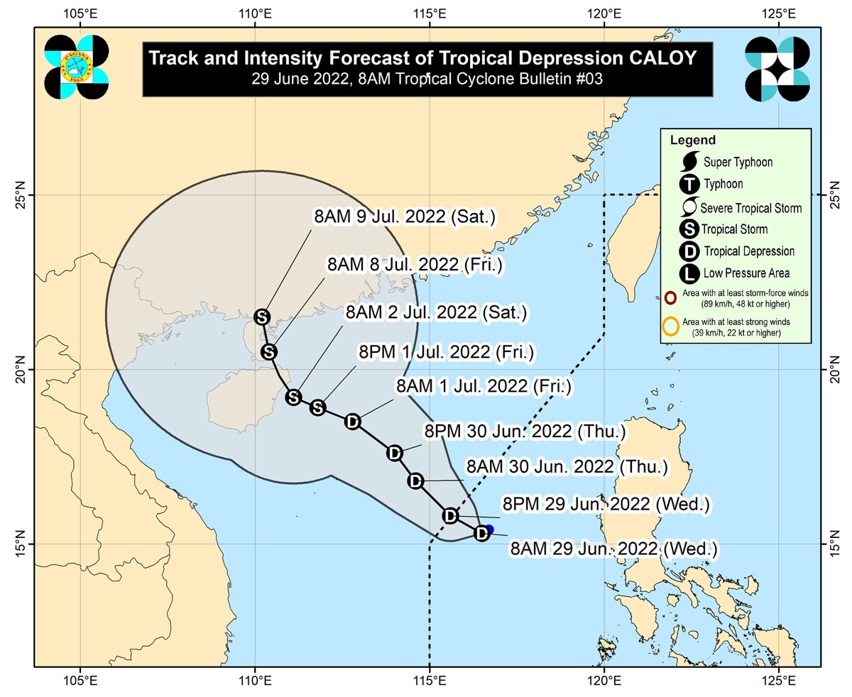
This image shows the track and intensity forecast of Caloy. PAGASA
"Itong si Caloy, halos nandito na sa western boundary na ng ating area of responsibility, so inaasahan natin o malaki ang tsansa ngayong araw na lumabas na ito. Ngunit ang binabantayan natin ngayon is iyong dalang habagat... na puwedeng magdulot ng mga pag-ulan," Ordinario said.
(Caloy has almost reached the western boundary of our area of responsibility, so we expect that it would likely leave today. But we are monitoring the southwest monsoon which could bring rains.)
Caloy could strengthen into a tropical storm after leaving the Philippine area as it heads to southern China, he added.
He said PAGASA did not raise any tropical cyclone wind signal because of Caloy's distance from the country.
But the tropical depression and the enhanced habagat will bring moderate to rough seas off Northern Luzon and the western parts of Central and Southern Luzon, warned PAGASA.
"These conditions may be risky for those using small seacrafts. Mariners are advised to take precautionary measures when venturing out to sea and, if possible, avoid navigating in these conditions," said the agency.
ABS-CBN is the leading media and entertainment company in the Philippines, offering quality content across TV, radio, digital, and film. Committed to public service and promoting Filipino values, ABS-CBN continues to inspire and connect audiences worldwide.
Our website is made possible by displaying online
advertisements to our visitors. Please consider supporting
us by disabling your ad blocker on our website.
Our website is made possible by displaying online
advertisements to our visitors. Please consider supporting
us by disabling your ad blocker on our website.