Welcome, Kapamilya! We use cookies to improve your browsing experience. Continuing to use this site means you agree to our use of cookies. Tell me more!
‘Chedeng’ now a severe tropical storm but no direct effect yet on PH
‘Chedeng’ now a severe tropical storm but no direct effect yet on PH
ABS-CBN News
Published Jun 08, 2023 12:13 AM PHT
|
Updated Jun 08, 2023 09:53 AM PHT
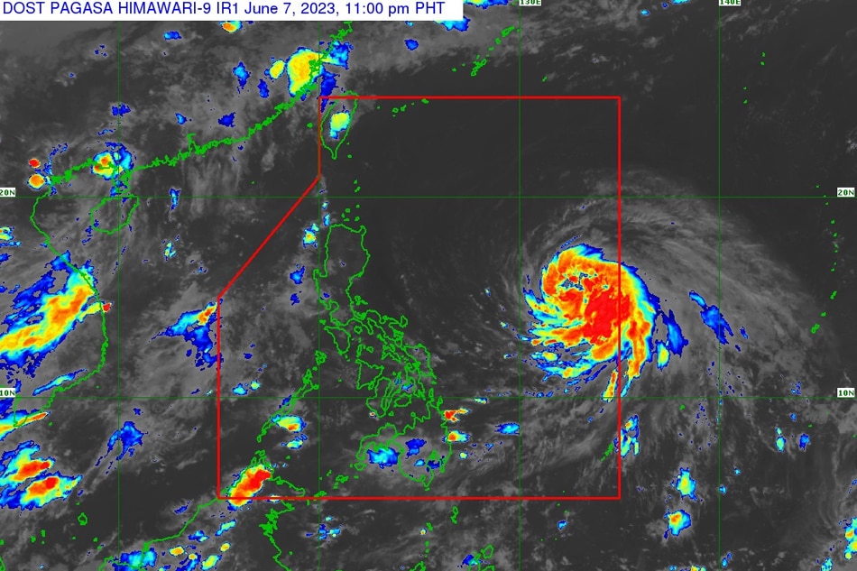
Satellite image of Severe Tropical Storm Chedeng. PAGASA.
MANILA - Tropical cyclone Chedeng (international name: Guchol) still does not directly affect the country’s weather even as it further intensified into a severe tropical storm, the state weather bureau said late Wednesday.
In its 11 p.m. weather bulletin, PAGASA said Chedeng was last located 1,220 kilometers east of southeastern Luzon, packing maximum sustained winds of 95 kilometers per hour near the center, with gusts of up to 115 kph.
It is currently moving west northwest at 10 kph.
Despite further intensification, PAGASA said Chedeng is unlikely to directly bring heavy rainfall over any portion of the country in the next three to five days.
ADVERTISEMENT
“A weather advisory will be issued by PAGASA should there be an increasing chance of monsoon heavy rainfall within the next three days,” the agency said.
Chedeng is expected to remain far from the Philippine landmass, moving generally west northwest or northwest from Wednesday night through Friday before slowing down while turning north.
It is projected to further intensify in the next three days and may reach typhoon category by Thursday.
“Peak intensity may be reached by Friday or Saturday,” PAGASA said.
Chedeng is forecast to leave the Philippine area of responsibility between late Sunday and early Monday, according to the weather bureau.
ABS-CBN is the leading media and entertainment company in the Philippines, offering quality content across TV, radio, digital, and film. Committed to public service and promoting Filipino values, ABS-CBN continues to inspire and connect audiences worldwide.
Our website is made possible by displaying online
advertisements to our visitors. Please consider supporting
us by disabling your ad blocker on our website.
Our website is made possible by displaying online
advertisements to our visitors. Please consider supporting
us by disabling your ad blocker on our website.