Welcome, Kapamilya! We use cookies to improve your browsing experience. Continuing to use this site means you agree to our use of cookies. Tell me more!
‘Amang’ weakens slightly as it makes landfall over Catanduanes
‘Amang’ weakens slightly as it makes landfall over Catanduanes
ABS-CBN News
Published Apr 12, 2023 12:27 AM PHT
|
Updated Apr 12, 2023 06:50 AM PHT
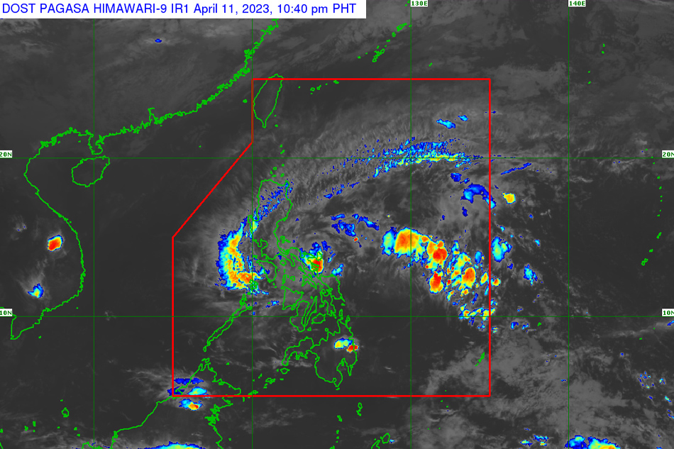
Satellite image of tropical depression Amang. PAGASA
MANILA - Tropical depression Amang slightly weakened as it hit land Tuesday night, state weather bureau PAGASA said.
In its 11 p.m. bulletin, PAGASA said Amang, the country’s first tropical depression for 2023, made landfall in the vicinity of Panganiban in Catanduanes.
It is packing maximum sustained winds of 45 kilometers per hour near the center, with gusts of up to 60 kph.
PAGASA raised signal no. 1 in the following areas, where 39 to 61 kph winds could be expected in 36 hours.
ADVERTISEMENT
LUZON
*Catanduanes
*Sorsogon
*Albay
*Camarines Sur
*Camarines Norte
*Quezon including Pollilo Islands, Marinduque, Ticao Island, Burias Island
*Rizal
*Laguna (San Pablo City, Alaminos, Calauan, Bay, Los Baños, Rizal, Nagcarlan, Victoria, Pila, Liliw, Magdalena, Majayjay, Luisiana, Cavinti, Pagsanjan, Santa Cruz, Lumban, Kalayaan, Paete, Pakil, Pangil, Siniloan, Famy, Santa Maria, Mabitac)
*Aurora
*Bulacan (Norzagaray, Doña Remedios Trinidad, San Miguel, San Ildefonso)
*Quirino
*Nueva Vizcaya (Kasibu, Dupax del Norte, Dupax del Sur, Alfonso Castaneda)
*Nueva Ecija (General Tinio, City of Gapan, Peñaranda, San Leonardo, Santa Rosa, Cabanatuan City, Talavera, San Jose City, Carranglan, Pantabangan, Llanera, General Mamerto Natividad, Rizal, Bongabon, Laur, Palayan City, Gabaldon)
*Isabela (Echague, San Agustin, Jones, Dinapigue, San Mariano, San Guillermo, Palanan, Angadanan, Benito Soliven, City of Cauayan)
VISAYAS
Northern Samar
The areas placed under signal no. 1 could experience strong winds brought about by the storm. PAGASA said the threat to life and property is "minimal to minor."
RAINFALL
Amang could dump from 50 millimeters to 100 mm of rain over the Bicol region from Tuesday to Wednesday night.
It may bring heavy rains over Bicol, the northern and southeastern portions of Quezon, and the eastern portions of Rizal and Laguna from Tuesday night until Friday night.
OUTLOOK
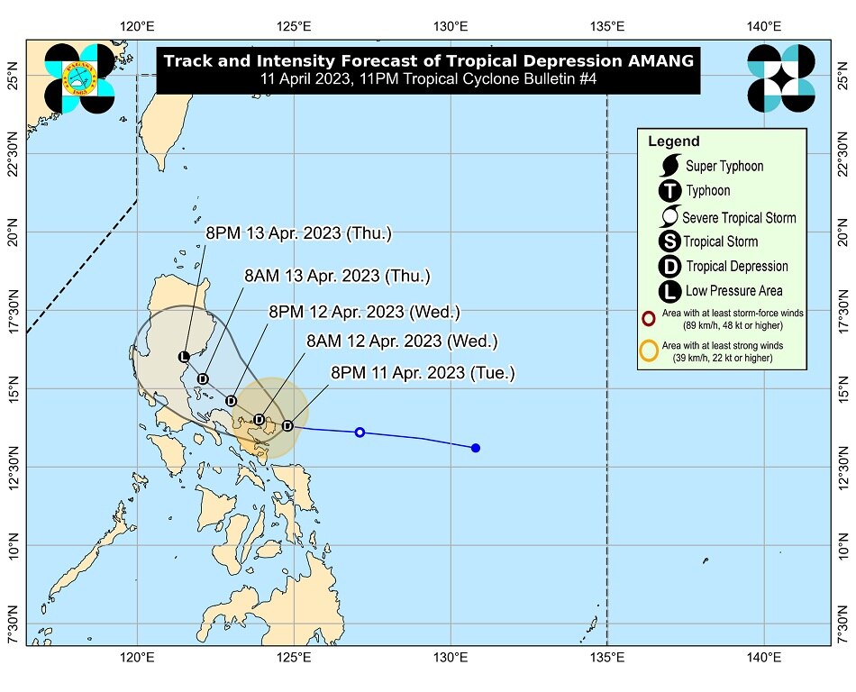
Forecast track of Tropical Depression Amang. PAGASA
Amang is currently moving westward at 15 kph, and is expected move generally westward or west northwestward in the next 12 to 24 hours.
Its center will move over the the coastal municipalities of Camarines Provinces before turning more northwestward towards the waters east of Quezon, with the possibility of passing near or over the Polillo Islands, PAGASA also added.
Amang may make another landfall over Aurora by Thursday afternoon or evening, and is expected to remain a tropical depression for much of the forecast period.
“It is likely to weaken into a low pressure area by late Thursday due to increasing vertical wind shear, intrusion of dry air, and interaction with the rugged landmass of eastern Luzon,” PAGASA also said.
ABS-CBN is the leading media and entertainment company in the Philippines, offering quality content across TV, radio, digital, and film. Committed to public service and promoting Filipino values, ABS-CBN continues to inspire and connect audiences worldwide.
Our website is made possible by displaying online
advertisements to our visitors. Please consider supporting
us by disabling your ad blocker on our website.
Our website is made possible by displaying online
advertisements to our visitors. Please consider supporting
us by disabling your ad blocker on our website.